
This post contains affiliate links. If you book through one, I may earn a small commission at no extra cost to you — it helps keep Jet Lag Jelly running. Read my full affiliate disclosure for more.
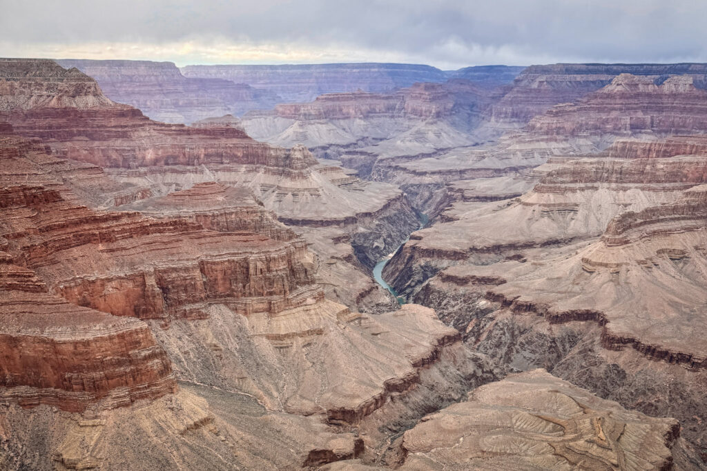
There are places that disappoint you slightly in real life because you’ve seen too many photos of them. The Grand Canyon is not one of those places. Standing at the rim for the first time, the sheer scale of it — the layers, the depth, the Colorado River looking like a tiny silver thread at the bottom — genuinely short-circuits your brain for a moment. No photo, including mine, does it justice.
The South Rim is the most visited and most accessible section of Grand Canyon National Park, offering dramatic canyon views, historic lodges, scenic overlooks, shuttle routes, hiking trails, museums, restaurants, and year-round visitor services. If it’s your first visit, this is where you want to be.
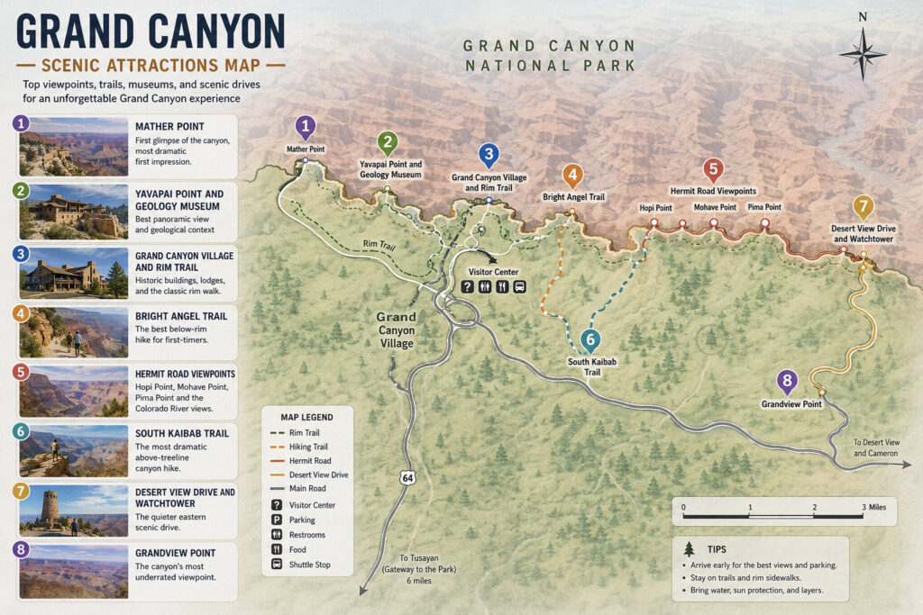
Grand Canyon Scenic Itinerary
1. Mather Point: First glimpse of the canyon, most dramatic first impression
2. Yavapai Point and Geology Museum: Best panoramic view and geological context
3. Grand Canyon Village and Rim Trail: Historic buildings, lodges, and the classic rim walk
4. Bright Angel Trail: The best below-rim hike for first-timers
5. Hermit Road Viewpoints: Hopi Point, Mohave Point, Pima Point and the Colorado River views
6. South Kaibab Trail: The most dramatic above-treeline canyon hike
7. Desert View Drive and Watchtower: The quieter eastern scenic drive
8. Grandview Point: The canyon’s most underrated viewpoint
Did You Know?
- The Grand Canyon is 277 miles (446 km) long, up to 18 miles (29 km) wide, and over a mile (1.6 km) deep
- The oldest exposed rock at the bottom — the Vishnu Schist — is nearly 1.8 billion years old
- The Colorado River has been carving the canyon for approximately 5 to 6 million years
- Located in northern Arizona, about 450 kilometres from Las Vegas
- Over 6 million visitors per year make it one of the most visited national parks in the US
- Best seasons: November through February for fewer crowds; March–May and September–November for comfortable temperatures
Getting There: From Las Vegas, it's roughly 450 kilometres to the South Rim — about 4.5 to 5 hours via US-93 S through Kingman, then I-40 E and AZ-64 N. From Zion National Park, it's a similar distance heading southeast. Worth noting: the West Rim is only about 200 kilometres from Las Vegas and takes around 2.5 hours, but it's managed by the Hualapai Tribe rather than the National Park Service and offers a very different, more limited experience — the South Rim is where you want to go for the full Grand Canyon. If you're starting from Las Vegas, renting a car is the easiest way to make this drive.

Entrance Fee: $35 per vehicle, valid for 7 days and covering everyone in the car. The America the Beautiful annual pass covers entry and pays for itself if you're hitting multiple parks on this road trip.

Summer vs. Winter: If you want to avoid crowds, the best time to visit is from November through February. In winter, temperatures are cool and manageable, crowds are dramatically thinner, and the views of the canyon dusted with snow are a spectacularly beautiful sight. We visited in February and had many viewpoints almost entirely to ourselves.

Getting Around: The free park shuttle bus system is the best way to get around, efficiently connecting Grand Canyon Village to all of the major trailheads and overlooks. In winter, Hermit Road is open to private vehicles — giving you much more flexibility to stop wherever you want.

How Long to Spend: One full day covers the South Rim highlights comfortably. Two days lets you add longer hikes and catch both a sunrise and a sunset at the canyon.
1. Mather Point
Start with the classic rim views at Mather Point near the visitor center. This is where most people see the Grand Canyon for the very first time — and it delivers. Standing at the railing with the entire canyon opening up in front of you, layers of red, pink, and grey rock stretching all the way to the North Rim — it’s the kind of view that makes you go quiet for a moment.
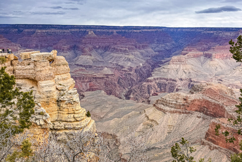
What makes Mather Point special as a first stop is the immediacy of it — you park, walk two minutes, and suddenly the ground drops away a mile below you. The scale hits you instantly and completely.
Fun Fact: Mather Point is named after Stephen Mather, the first director of the National Park Service, and sits at an elevation of around 2,170 metres above sea level — yet you're still looking down into a canyon that drops another 1.6 kilometres below you. The oldest rock visible at the bottom of the canyon from this viewpoint is nearly 1.8 billion years old.

Useful Information: Mather Point is one of the most popular first stops for dramatic canyon views, located near the main visitor center. It's a short, easy walk from the main parking area. Parking lots and overlooks can fill by 10am on busy days — arrive early or use the shuttle.

Jet Lag Jelly Tip: Don't just stop at the main railing. Walk the short trail that loops around the point — the views shift dramatically with every few steps and the crowds thin out fast once you move away from the main platform.
2. Yavapai Point and Geology Museum
A short walk west along the Rim Trail from Mather Point, Yavapai Point offers wide canyon views and nearby visitor facilities. The Yavapai Geology Museum here makes the canyon make sense — with exhibits explaining the 1.8 billion years of rock layers you’re looking at, laid out in a way that transforms the view from “very big hole” into something genuinely mind-bending.
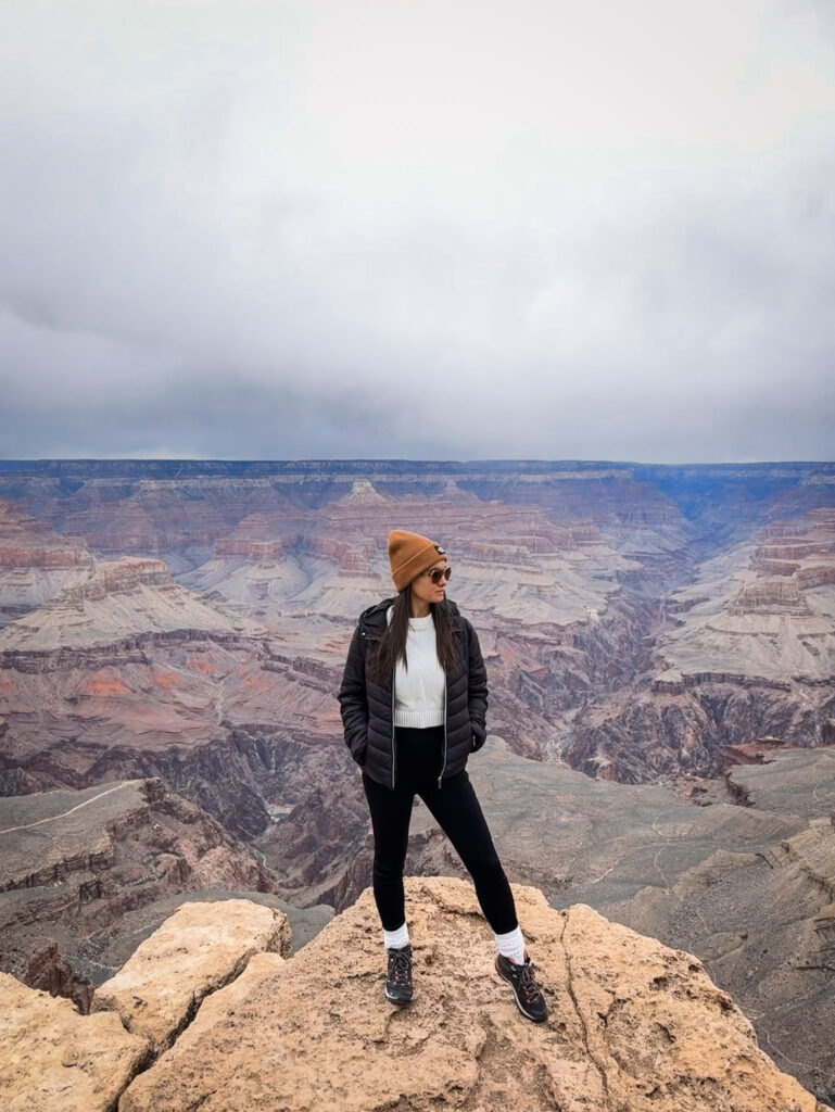
From Yavapai Point you can also see the Colorado River — one of the few viewpoints on the eastern section of the rim where the river is actually visible far below.
Fun Fact: The oldest exposed rock at the bottom of the Grand Canyon — the Vishnu Schist — is nearly 1.8 billion years old, making it some of the oldest exposed rock on Earth. The canyon walls are essentially a geological timeline spanning almost half the age of the planet.

Useful Information: The Geology Museum is free with park entry and is open daily. The viewpoint here is also notably less crowded than Mather Point despite being just a short walk away — a worthwhile trade-off for a better viewing experience.

Jet Lag Jelly Tip: If you only read one information panel in the whole park, make it the rock layer diagram here — it reframes the entire canyon from a big impressive hole into something that genuinely staggers you when you understand what you're actually looking at.
3. Grand Canyon Village and the Rim Trail
The historic heart of the South Rim — a cluster of lodges, restaurants, visitor facilities and museums right on the canyon edge, including the iconic El Tovar Hotel which has been welcoming guests since 1905. The Rim Trail passes right through here, connecting the village to viewpoints in both directions along the canyon edge.
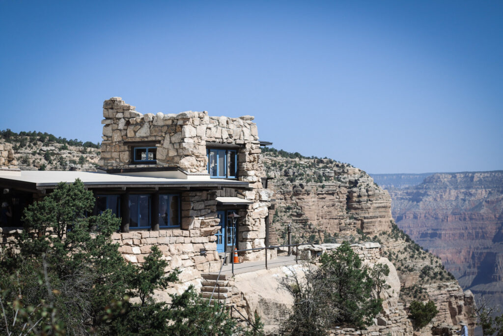
The Grand Canyon Rim Trail is a continuous path that follows the edge of the South Rim, running for roughly 21 kilometres between the South Kaibab Trailhead in the east and Hermits Rest in the west. You don’t need to walk all of it — the trail works more like a flexible walking route that you can join and leave wherever you like, passing through Grand Canyon Village and connecting many of the main viewpoints, running alongside the park’s shuttle routes so you can walk a section then hop on a bus when you’re done.
Fun Fact: The El Tovar Hotel, built in 1905, is one of the oldest and most storied lodges in the US National Park system — it has hosted presidents, celebrities, and royalty, and still offers some of the most dramatic canyon-view dining in the world.

Useful Information: Grand Canyon Village has restrooms, restaurants, gift shops, and the Bright Angel Lodge and El Tovar Hotel. The Rim Trail between the Village and Yavapai Point is paved and mostly accessible. No permit required for the Rim Trail.

Jet Lag Jelly Tip: Walk at least the section of the Rim Trail between Mather Point and Yavapai Point — it's less than 2 kilometres, flat and paved, and gives you continuously changing views of the canyon that no single viewpoint can match.
4. Bright Angel Trail
The most accessible below-rim hike at the Grand Canyon and the best option for first-timers — a well-maintained trail that descends from the South Rim through a series of switchbacks, past two rest houses with water and toilets, all the way down to the Colorado River at the bottom. Most day hikers turn around at the 1.5 Mile Resthouse or 3 Mile Resthouse rather than attempting the full descent to the river.
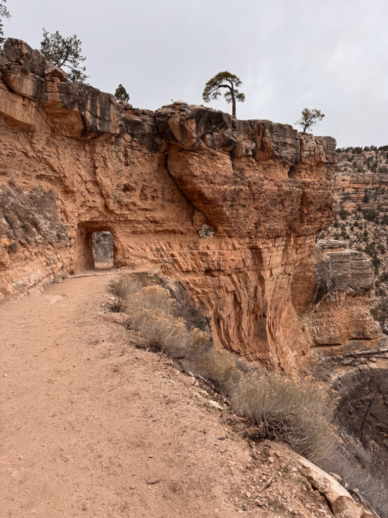
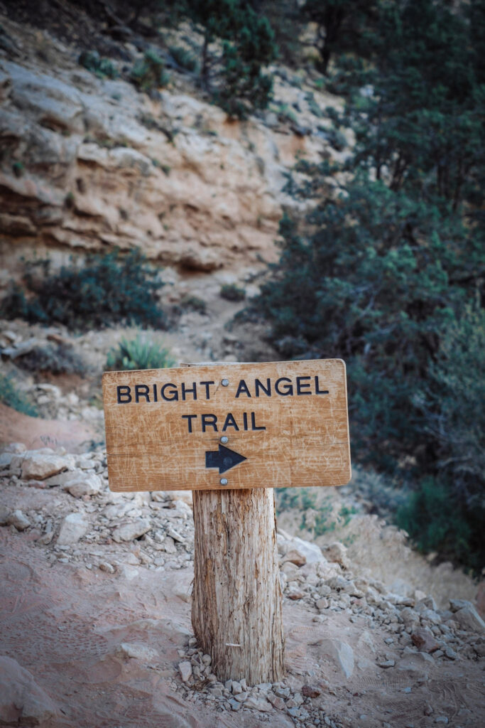
Even the first 15 minutes descending into the canyon shifts the whole perspective — the rim disappears above you, the canyon walls close in on both sides, and suddenly the scale of the place clicks in a completely different way to any rim viewpoint.
Fun Fact: The Bright Angel Trail is easier to manage, simpler to access, and usually a better learning trail than the South Kaibab Trail. The trail follows an ancient Havasupai route used for thousands of years before it became one of the park's main hiking corridors.

Useful Information: The NPS strongly advises against hiking to the river and back in a single day — it's a 15-kilometre round trip with brutal elevation change and the climb back out in summer heat has led to many rescues. As of April 2026, the Bright Angel trailhead water is on — always check current conditions at the visitor center before descending. No permit required for day hiking.

Jet Lag Jelly Tip: Even just going 20 to 30 minutes down the trail is worth it — you don't need to do the full hike to get a completely different perspective on the canyon. The rim disappears, the walls close in, and suddenly you understand why this place is considered one of the great natural wonders of the world.
5. Hermit Road Viewpoints: Hopi Point, Mohave Point and Pima Point
Hermit Road runs along the rim for about 11 kilometres west of Grand Canyon Village and is where the most dramatic Colorado River views on the South Rim are found. Hermit Road is closed to private vehicles for much of the year, so the shuttle is the only way to access that stretch unless you’re walking or cycling — but in winter, you can drive the full length yourself and stop wherever the view demands it.
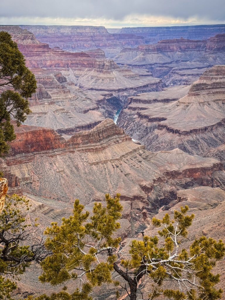
Hopi Point is the standout — one of the furthest-reaching panoramic views on the entire South Rim, with the river curving dramatically below. Mohave Point and Pima Point both deliver their own extraordinary angles on the canyon, with the Colorado River clearly visible from all three on a clear day.
Fun Fact: Hermit Road was originally built in 1912 as an alternative to the toll road at Bright Angel Trail, allowing visitors free access to the western viewpoints. The Colorado River is only visible from certain western viewpoints — if seeing the river is on your list, you need to drive or shuttle along this road.

Useful Information: If you want to explore the quieter western section toward viewpoints like Hopi Point or Mohave Point, you'll need to use the Hermits Rest (red) shuttle during spring through autumn. In winter, drive your own car all the way to Hermits Rest and stop wherever you want.

Jet Lag Jelly Tip: Don't stop at Mather Point and call it a day — the western viewpoints along Hermit Road are where the Colorado River becomes properly visible and the canyon reveals its most dramatic western perspective. Pima Point is the furthest and least crowded, and has one of the best river views in the entire par
6. South Kaibab Trail
If Bright Angel is the accessible, well-serviced introduction to below-rim hiking, South Kaibab is the dramatic, exposed, no-shade alternative that delivers some of the most extraordinary views in the entire canyon. The trail descends along a ridge rather than a side canyon, meaning you have unobstructed 360-degree views of the canyon for almost the entire descent — which is both spectacular and terrifying.
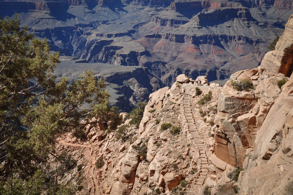
Most day hikers go to Ooh Aah Point (1.8 kilometres return) or Cedar Ridge (4.8 kilometres return) rather than attempting the full descent to the river. Both offer outstanding views that surpass most rim viewpoints.
Fun Fact: Hiking to Ooh Aah Point provides stunning, expansive views of the Colorado River deep below — and it's only about 45 minutes of hiking from the trailhead, making it one of the best view-to-effort ratios in the park.

Useful Information: The South Kaibab Trail is spectacular but asks for more planning — it's more exposed, and as of April 2026 the South Kaibab trailhead water is off, so bring all water you'll need from the visitor center. No permit required for day hiking. Access is via the Kaibab/Rim Route (orange) shuttle only — no private vehicle parking at the trailhead.

Jet Lag Jelly Tip: Go early morning — the exposed ridgeline offers no shade whatsoever, and the trail gets extremely hot by mid-morning even in cooler months. Sunrise on the South Kaibab ridge is one of the most extraordinary experiences in the park.
7. Desert View Drive and the Watchtower
The quieter, less-visited eastern side of the South Rim — a 40-kilometre scenic drive from Grand Canyon Village to Desert View, with a series of overlooks along the way that get progressively less crowded the further east you go. At the end of the drive, Desert View Watchtower is the easternmost developed area of the South Rim — a 21-metre stone tower designed by architect Mary Colter in 1932, inspired by ancient Ancestral Puebloan towers found throughout the Southwest.
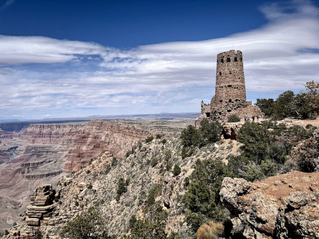
From the top of the Watchtower, the view stretches east toward the Navajo Nation and the Painted Desert — a completely different perspective on the canyon from anything available on the western rim.
Fun Fact: Moran Point along Desert View Drive is one of the few viewpoints along the South Rim where all three distinct rock groups that make up the canyon's many layers can be seen. The Watchtower itself is considered one of Mary Colter's masterpieces and is listed on the National Register of Historic Places.

Useful Information: Desert View Drive is open to private vehicles year-round — unlike Hermit Road, you can always drive this yourself. The drive takes about an hour one way with stops. Desert View has a petrol station, gift shop, and snack bar — the only facilities on this side of the park.

Jet Lag Jelly Tip: Desert View is the best bonus area if you have a car and extra time — it's significantly less crowded than the Village area and the drive itself is beautiful. If you're short on time, Lipan Point along the way is worth a quick stop for outstanding Colorado River views.
8. Grandview Point
One of the most underrated viewpoints on the entire South Rim — further along Desert View Drive, Grandview Point offers a sweeping view of the canyon that many seasoned visitors consider more impressive than Mather Point, with a particularly dramatic perspective on the Horseshoe Mesa below.
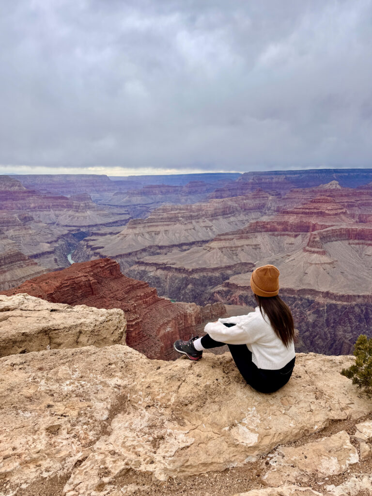
The Grandview Trail descends steeply from here to Horseshoe Mesa — one of the most rewarding day hikes in the park for experienced hikers, passing through mining ruins from the late 1800s.
Fun Fact: Grandview Point was the site of one of the first tourist facilities at the Grand Canyon — the Grandview Hotel, which opened in 1897 and predated the establishment of the national park by over 20 years. The copper mines on Horseshoe Mesa below were operational in the 1890s and helped put the Grand Canyon on the tourist map.

Useful Information: Grandview Point has a small parking area and is accessible by private vehicle year-round. The Grandview Trail to Horseshoe Mesa is 6.4 kilometres return and rated strenuous — steep, rocky, and unmaintained in sections. No water available on the trail.

Jet Lag Jelly Tip: Most visitors skip Grandview in favour of the main Village viewpoints — which means on a busy day you can have this extraordinary viewpoint almost entirely to yourself. If you're driving Desert View Drive, this is a non-negotiable stop.
Best Time to Visit
The South Rim is open year-round, but conditions vary a lot by season. Spring (March-May) and fall (September-November) hit the sweet spot — mild temps, thinner crowds, and clear skies for those big canyon views. Summer (June-August) brings heat, monsoon storms, and peak crowds — book everything well in advance if you’re going then. Winter (December-February) is quiet and beautiful, occasionally with snow dusting the rim, but some roads and viewpoints close.
Jet Lag Jelly Tip: If you're only doing the South Rim, sunrise and sunset at Mather Point are worth setting an alarm for — the light hits the canyon walls completely differently than midday.
Where to Stay
If you can, staying overnight near the South Rim makes a huge difference — you get sunrise and sunset light without the long drive back to Vegas twice in one day.
Inside the park: Lodges like El Tovar, Bright Angel Lodge, and Kachina/Thunderbird are all run by the park concessionaire and put you steps from the rim — but they book up months in advance, especially in peak season.
Just outside the park (Tusayan): if the in-park lodges are full, Tusayan is literally minutes from the South Rim entrance and has a solid range of hotels — The Grand Hotel, Red Feather Lodge, and Holiday Inn Express are all popular, reliable options.
Book your accommodation as far ahead as you can, especially for anything inside the park itself.
Budget
Backpacker: ~$35–55/day — camping (Mather Campground), gas, park entrance fee, self-catered food
Mid-range: ~$110–180/day — rental car, hotel in Tusayan or Williams, mix of dining
Luxury: $300+/day — lodges inside the park (El Tovar), guided mule rides or helicopter tours, fine dining
Fun Fact: The Grand Canyon's $35 vehicle entrance fee is valid for 7 days and covers both the South and North Rim — worth planning around if you want to see both sides.
FAQ
Is one day enough for the Grand Canyon South Rim? Yes, for the highlights — Mather Point, Yavapai Point, the Rim Trail, and one Hermit Road viewpoint or two are doable in a day. Two days lets you add a below-rim hike and catch both a sunrise and sunset.
Do you need a car at the Grand Canyon South Rim? Not necessarily — the free park shuttle connects Grand Canyon Village to all the major trailheads and overlooks. A car becomes more useful in winter, when Hermit Road opens to private vehicles.
What’s the best time to visit the Grand Canyon South Rim? Spring (March–May) and fall (September–November) for mild temps and thinner crowds. November through February brings the fewest visitors overall, though some roads and viewpoints close in winter.
Which Grand Canyon hike is best for beginners? Bright Angel Trail — well-maintained switchbacks with rest houses along the way. Even just 20–30 minutes below the rim gives a completely different perspective without committing to a long hike.
Can you see the Colorado River from the South Rim? Only from certain viewpoints — Yavapai Point offers a glimpse, but the clearest river views are along Hermit Road at Hopi Point, Mohave Point, and Pima Point.
Summary
The Grand Canyon is one of those places where every superlative you’ve ever read about it turns out to be an understatement. The photos don’t do it justice. The descriptions don’t do it justice. The only thing that actually does it justice is standing at the edge yourself.
Here’s the quick rundown of everything covered:
Mather Point — The classic first view. Still extraordinary despite the crowds.
Yavapai Point and Geology Museum — Less crowded than Mather, better context, visible Colorado River.
Grand Canyon Village and Rim Trail — Historic, atmospheric, and the best way to connect the viewpoints on foot.
Bright Angel Trail — Go at least 20 minutes below the rim. The perspective shift is worth it.
Hermit Road — Hopi, Mohave and Pima Points — This is where the Colorado River becomes visible. Don’t skip it.
South Kaibab Trail — Go to Ooh Aah Point. Go early. Bring all your water.
Desert View Drive and Watchtower — The quieter, less-crowded eastern half of the park. Always worth the drive.
Grandview Point — The most underrated viewpoint on the South Rim. Almost always uncrowded.
One day is enough to see the highlights. But the Grand Canyon will make you want to come back — for a sunrise, for a below-rim hike, or just to stand at the edge one more time and let the scale of it hit you all over again.
Part of my Southwest national parks series — check out my Exploring Antelope Canyon, Horseshoe Bend Overlook Guide, Valley of Fire Day Trip from Las Vegas, Zion National Park: The Complete Guide, and Death Valley Must-See Stops posts too if you’re building out a bigger Arizona/Nevada itinerary — or start with my Best National Parks You Can Visit From Las Vegas roundup for the full picture.