
This post contains affiliate links. If you book through one, I may earn a small commission at no extra cost to you — it helps keep Jet Lag Jelly running. Read my full affiliate disclosure for more.
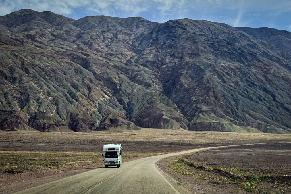
Just two hours west of Las Vegas, Death Valley National Park feels like stepping onto another planet. It’s the closest national park to the Strip, but also one of the most extreme landscapes in North America — a place of salt flats, sand dunes, volcanic craters, and colourful desert mountains that shift with the light throughout the day.
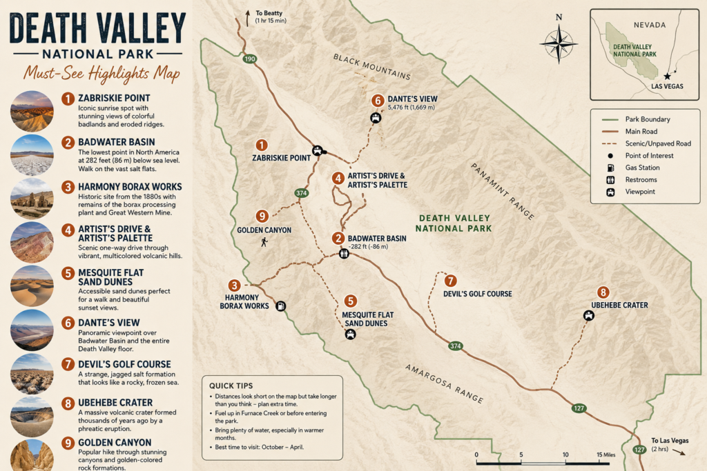
Death Valley Scenic Itinerary
- Zabriskie Point: Golden badlands at sunrise
- Badwater Basin: Lowest point in North America (-282 ft / -86 m)
- Harmony Borax Works: The most famous mining operations
- Artist’s Drive & Artist’s Palette: Colorful volcanic hills
- Mesquite Flat Sand Dunes: Iconic desert dunes
- Dante’s View: Panoramic overlook of the valley
- Devil’s Golf Course: Jagged salt formations
- Ubehebe Crater: Massive volcanic crater
- Golden Canyon: Beautiful hiking trail through golden rock walls
Did you know?
- Record temperature: 56.7°C (134°F) (highest air temperature ever recorded on Earth)
- Lowest point in North America: Badwater Basin (-282 ft / -86 m)
- California & Nevada
- Over 3.4 million acres of protected desert
- Best seasons: October–April
Despite its intimidating name, Death Valley is absolutely worth visiting if you time it right. The best season is October through April, when temperatures are manageable and the park is at its most photogenic. In summer, temperatures regularly exceed 45°C and hiking after 10am is genuinely dangerous — the park has seen fatalities from heat exposure every year.
Getting There: from Las Vegas, it's roughly a 2 to 2.5 hour drive via NV-160 W through Pahrump, then onto CA-190 W straight into the park. You'll need a car — there's no public transport into the park. Renting a car from Las Vegas is essential for this one.

Entrance Fee: $35 per vehicle, valid for 7 days and covering everyone inside. Payment is made at automated kiosks throughout the park — card only, no cash. If you're hitting multiple national parks on this road trip, the America the Beautiful annual pass ($80) pays for itself quickly.

Jet Lag Jelly Tip: Cell service is virtually nonexistent once you're inside the park. Download offline maps before you go, fill up your tank in Pahrump, and bring far more water than you think you'll need — the only water stations inside the park are at the Furnace Creek Visitor Center and Stovepipe Wells Ranger Station.
1. Zabriskie Point
The first stop of the day coming in from the east on CA-190, and already a contender for the best view. Standing on top of these golden, rippled badlands with the canyons folding into each other below — it doesn’t look real. It looks like a movie set for a planet that isn’t Earth. The swirling, eroded ridges change colour and texture as the light moves across them throughout the day, shifting from deep gold in the morning to pale cream in midday and back to burnt orange at sunset.
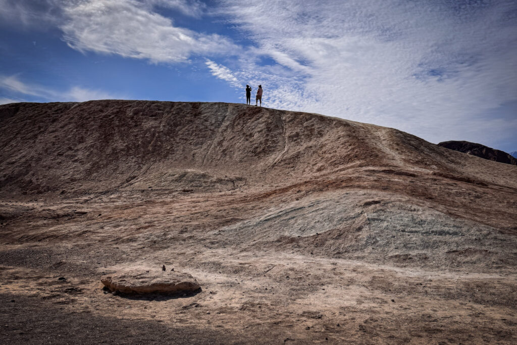
What makes Zabriskie Point special compared to other Death Valley viewpoints is the intimacy of it — you’re standing right on top of the badlands rather than looking down at them from a distance, which means you can walk out among the ridges and get completely different compositions with every few steps.
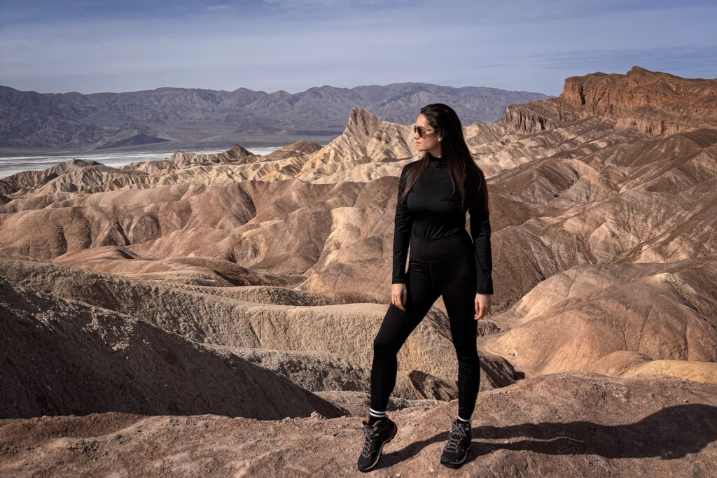
Fun Fact: These badlands were formed from the sediments of an ancient lake that dried up roughly 5 million years ago, and the wrinkled, layered texture is the result of constant erosion ever since. The point was named after Christian Brevoort Zabriskie, a vice president of the Pacific Coast Borax Company that mined heavily in this area in the early 20th century.

Useful Information: It's a short, paved walk from the parking lot — no real hike required for the main viewpoint, making it one of the easiest "wow" stops in the park. The area is open year-round and included in the park entrance fee. There are vault toilets at the parking area.

Jet Lag Jelly Tip: Go at sunrise if you can. The light hits the ridges in warm gold tones before the crowds arrive — by mid-morning it gets busy and the direct overhead light flattens out all that beautiful texture. If you can only do one thing at golden hour in Death Valley, make it Zabriskie Point.
2. Badwater Basin
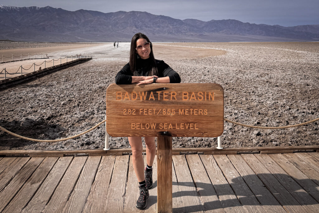
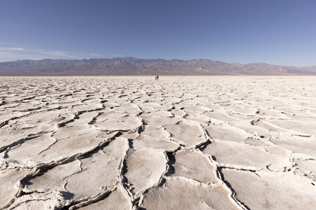
The lowest point in North America at 282 feet (86 metres) below sea level, and an endless white salt flat stretching out toward the Panamint Mountains. Standing at the sign feels like a milestone in itself, but walking out onto the salt flats is where it actually clicks just how vast and empty this place is — the mountains rising up on both sides, the white salt crust stretching to the horizon, and not a single plant or living thing in sight.
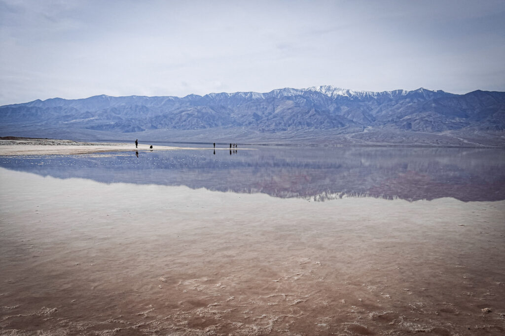
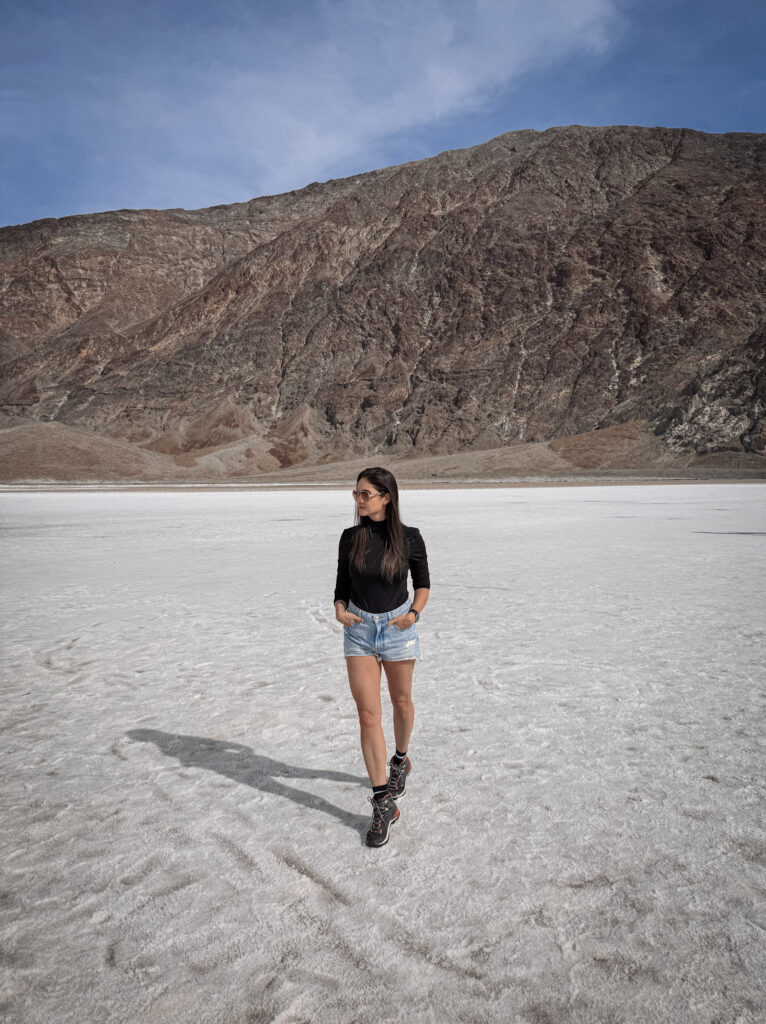
The hexagonal salt formations on the surface were created by cycles of flooding and evaporation over thousands of years. When winter rains fill the basin, a shallow lake temporarily appears — one of the most surreal sights in the park. By spring it evaporates again, leaving behind a fresh layer of salt crystals.
Fun Fact: If you look up at the cliff face above the parking area, there's a small "Sea Level" sign mounted on the rock — marking exactly how far below you actually are. The salt pan at Badwater Basin is one of the largest protected salt pans in North America, stretching over 200 square kilometres across the valley floor. The water that collects here is not actually drinkable — it's saturated with salt and minerals, hence the name "Badwater."

Useful Information: The salt flats are a flat, easy walk with no trail required. There are restrooms at the parking area. The walk out to the main salt formations takes about 10 to 15 minutes each way — go further than the first crowd of people for a better experience.

Jet Lag Jelly Tip: Walk out much further than the first group of people near the sign. The crowds thin out fast, and the hexagonal salt crust formations become more dramatic and better defined the deeper in you go. The silence out there — genuinely no sound at all — is one of the most memorable parts of the whole visit.
3. Harmony Borax Works
A quick but worthwhile detour just north of Furnace Creek — the ruins of one of Death Valley’s most famous mining operations, where borax was extracted from the valley floor in the 1880s and hauled out across the desert by the legendary 20-mule teams. The original wagons are still here, sitting in the open air exactly where they were left, and they’re bigger and more impressive in person than any photo suggests.
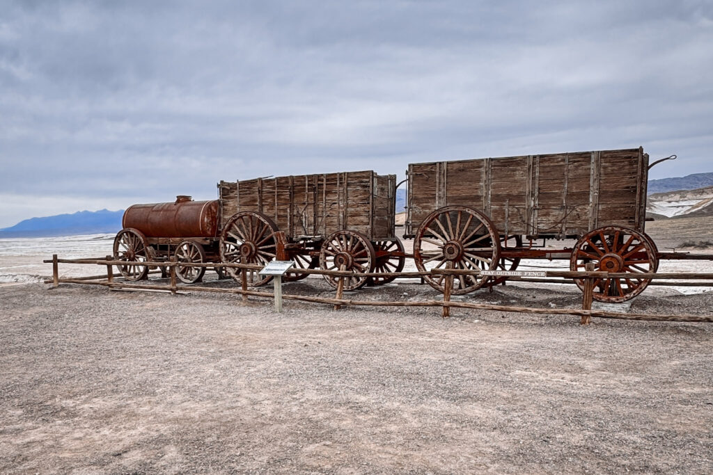
It’s one of those stops that reframes the whole landscape around you. Standing in the middle of Death Valley in February, even in pleasant weather, and thinking about the men who worked here through brutal summers to shovel borax crystals out of the salt flats — it puts the extremity of this place into a very human context.
Fun Fact: The 20-mule teams that hauled borax out of Death Valley each pulled two wagons and a water tank totalling around 36 tonnes in weight, across more than 265 kilometres of desert to the nearest railroad — a journey that took roughly 10 days each way. The operation ran from 1883 to 1889, when a railroad finally reached closer to the valley.

Useful Information: The site is right off Furnace Creek Road, just north of the visitor center — a very short, easy walk from the small parking area to the wagons and the ruins of the old borax works and processing area. Free to visit with your park entry. There's an informational board explaining the history of the operation.

Jet Lag Jelly Tip: A short detour but worth the 15 minutes if you want context for just how brutal this landscape was to work in, not just visit. It also makes for a great photo stop — the wagons against the backdrop of the valley are a classic Death Valley image.
4. Artist’s Drive and Artist’s Palette
A 14-kilometre one-way scenic loop through hills streaked with completely unexpected colour — pinks, greens, purples, and yellows splashed across the rock like someone took a paintbrush to the desert. After the stark white and gold of Badwater Basin and Devil’s Golf Course, the colour here feels almost unreal. It’s one of those stops where you keep saying “wait, is that natural?” to no one in particular.
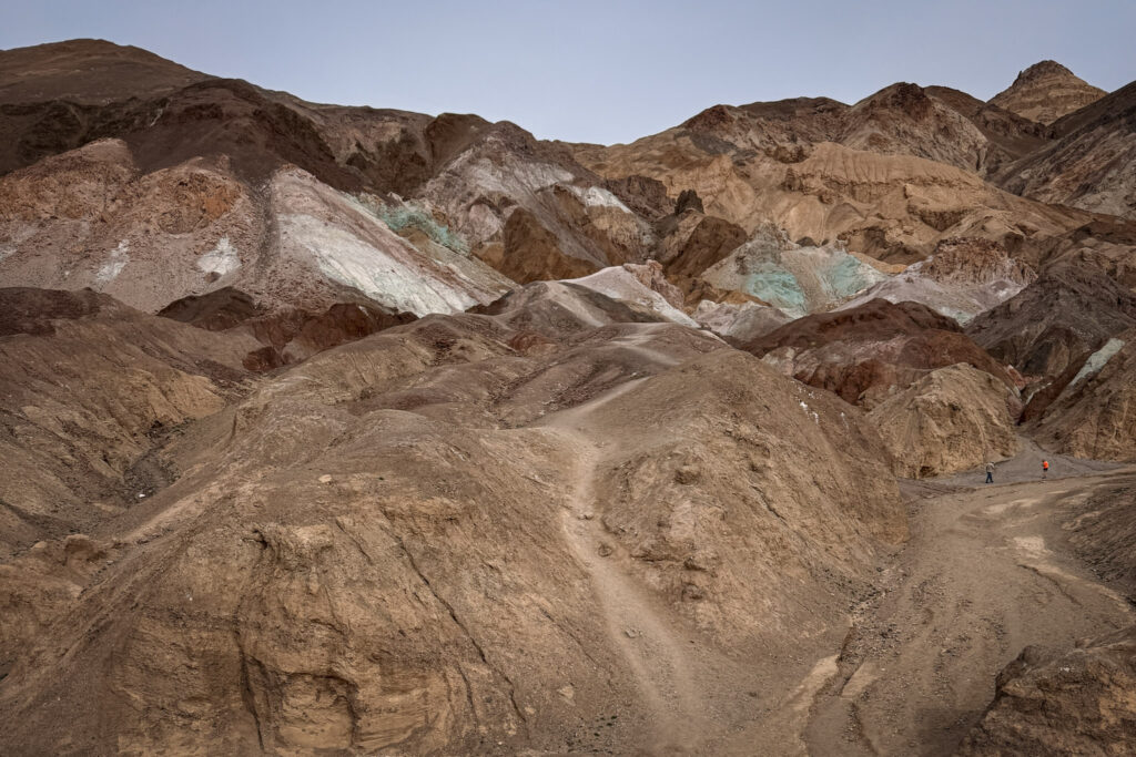
The one-way loop winds through increasingly dramatic formations until it reaches the Artist’s Palette viewpoint, where the hillsides are at their most vivid and the full palette of colours is visible in a single panoramic view.
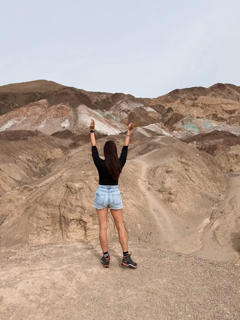
Fun Fact: The colours come from the oxidation of different metals in the volcanic rock — iron oxides create the reds, pinks and yellows, while mica and chlorite produce the greens, and manganese contributes to the purple tones. The colour intensity can vary significantly depending on the time of day and season.

Useful Information: Artist's Drive is a one-way loop — enter from the south end off Badwater Road and exit back onto Badwater Road at the north end. There's a designated pull-off partway through at Artist's Palette for the main photo stop. The road is paved and suitable for standard vehicles, though very large RVs and buses are not permitted.

Jet Lag Jelly Tip: Unlike most stops in Death Valley where golden hour is everything, midday light actually works better here — it hits the hillsides more directly and makes the colours pop more vividly than the softer warm tones of golden hour. Don't save this one for late afternoon.
5. Mesquite Flat Sand Dunes
Rolling, rippled sand dunes rising out of the flat desert floor, with the Cottonwood and Panamint Mountains as a backdrop and the Stovepipe Wells area spread out at the base. The dunes shift and change with every wind, meaning the patterns in the sand look completely different after any windstorm, and the ridgelines are constantly being redrawn by the desert air.
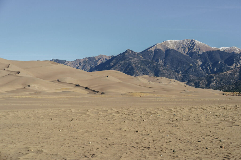
There’s something hypnotic about them that’s hard to explain — you keep walking out further, following one ridge to the next, and suddenly you’re much deeper into the dune field than you intended. This is a very good thing.
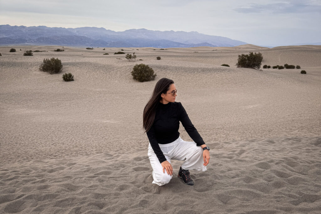
Fun Fact: Mesquite Flat Sand Dunes are some of the most accessible in the entire National Park system — no permit, no long hike, just walk in from the roadside parking area. The tallest dunes reach about 30 metres high. The dunes are made up of sand blown from the surrounding desert floor, and the individual grains are made of quartz, feldspar, and volcanic rock fragments.

Useful Information: The parking area is right off CA-190 near Stovepipe Wells — no entry required beyond the park fee. There's no marked trail, you simply pick a direction and walk. The more dramatic taller dunes are about a 20 to 30 minute walk from the parking lot. Sunrise and sunset are the best times to visit when the shadows on the ridges bring out the most dramatic texture.

Jet Lag Jelly Tip: Go barefoot if the sand temperature is manageable — the sand is incredibly soft and the feeling of walking on it is unlike anything else. Early morning also gives you the added bonus of undisturbed sand with no footprints yet, which makes for much cleaner photos.
6. Dante’s View at Sunset
The perfect finale to a full day in Death Valley — a viewpoint high above the valley floor, looking straight down over the entire basin as the sun drops behind the mountains. Drive back south from Ubehebe in the afternoon, and time your arrival at Dante’s View for the last hour of daylight. After a day spent at the lowest point in North America and wandering across salt flats and sand dunes, getting up to over 1,600 metres above sea level and seeing the whole valley laid out below you is one of the most dramatic perspective shifts you’ll experience anywhere.
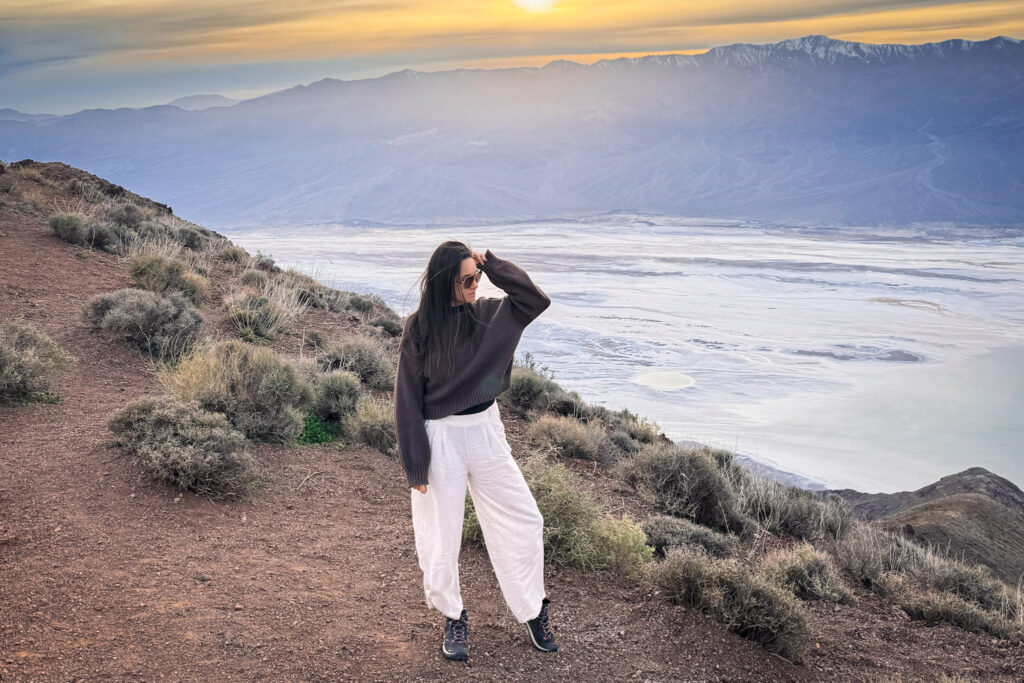
The view from here is extraordinary at any time of day, but sunset turns the entire basin into something almost impossibly beautiful — the salt flats of Badwater Basin glowing white far below, the shadows deepening in the canyon folds, the Panamint Mountains turning purple across the valley.
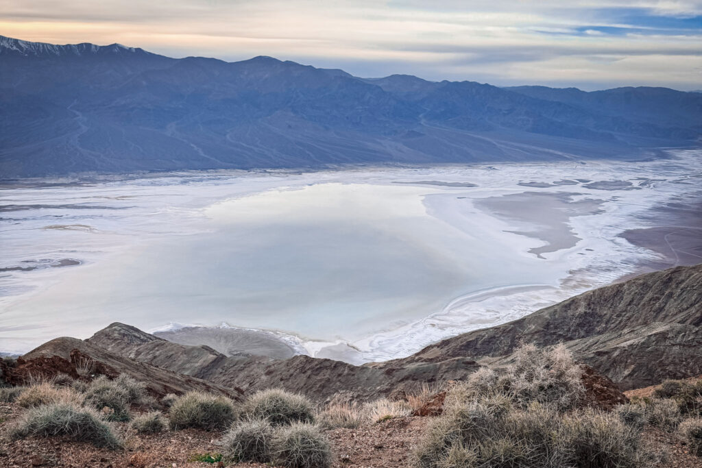
Fun Fact: From Dante's View, you can see both the lowest point in the contiguous United States (Badwater Basin, 86 metres below sea level directly below you) and, on a clear day, the highest point in the contiguous US — Mount Whitney — visible in the distance at 4,421 metres above sea level. The elevation difference between these two points, visible from a single location, is one of the greatest anywhere on Earth.

Useful Information: It's a fully paved road right up to the viewpoint — no hiking required, just drive up and enjoy. The road is not recommended for very large vehicles or RVs. Arrive at least 30 minutes before sunset to guarantee a parking spot, as it fills up quickly. Note that the access road is about 21 kilometres from the CA-190 junction, so factor in the drive.

Jet Lag Jelly Tip: Bring a warm layer regardless of season — it looks like the desert, but at this elevation the temperature drops significantly once the sun starts going down. February evenings at Dante's View are genuinely cold, which nobody warns you about.
7. Devil’s Golf Course
A short detour off Badwater Road on the way back north, and one of the strangest looking stops in the entire park. Devil’s Golf Course is an enormous expanse of jagged salt formations that rise from the valley floor like a field of crystalline spires, stretching as far as you can see in every direction. Walking among them — carefully — feels like stepping onto the surface of a very hostile moon.
If you listen carefully on a hot day, you’ll hear a faint popping and pinging sound — the sound is literally billions of tiny salt crystals bursting apart as they expand and contract in the heat. It’s one of those details that makes the place feel genuinely alive despite having absolutely nothing living in it.
Fun Fact: The name comes from a 1934 National Park Service guidebook that described the surface as so incredibly serrated that "only the devil could play golf on such rough links." Studies of the terrain suggest that this salt and gravel composite continues up to 300 metres below the surface.

Useful Information: Located about 13 kilometres south of the Furnace Creek Visitor Center — take the well-maintained gravel road turnoff from Badwater Road and follow it to the small parking area. The formations are best viewed from the parking area rather than walking on them, as the sharp salt formations can be dangerous to walk on and are also fragile and can be easily damaged. No restrooms at this stop — nearest facilities are at Badwater Basin.

Jet Lag Jelly Tip: This stop pairs perfectly with Badwater Basin on the same drive — they're close together and show two completely different sides of what happens when water evaporates from the same valley. Most people skip it in favour of the bigger name stops, which means you'll often have the place almost entirely to yourself.
8. Ubehebe Crater
In the far north of the park — about 90 kilometres from Furnace Creek, so factor in the drive — Ubehebe Crater is a detour that feels completely different from everything else on the Death Valley itinerary. The moment you reach the parking area and walk to the rim, the ground just drops away in front of you into an enormous volcanic crater: half a mile wide, up to 237 metres deep, with steep walls of layered volcanic rock in black, grey, orange and red. The wind at the rim is fierce and constant.
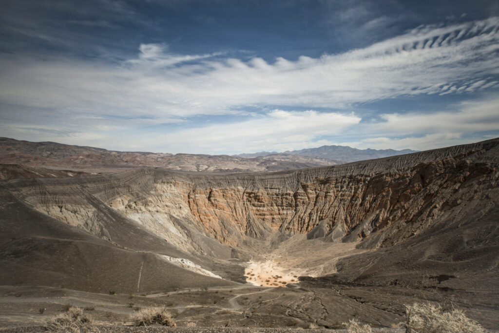
The crater was formed when magma migrating close to the surface caused groundwater to flash explosively into steam, throwing enormous quantities of pulverized rock across the surrounding desert. Geologists estimate this happened around 2,100 years ago — making it one of the most recent major volcanic events in the contiguous United States.
Fun Fact: "Ubehebe" derives from a Timbisha Shoshone term possibly meaning "big basket" or "big hole in the ground" — reflecting the crater's dramatic appearance from above. The Ubehebe volcanic field actually contains over a dozen craters in a 3 square kilometre area, with Ubehebe being the largest and youngest of them all.

Useful Information: The crater is easily viewed from the parking area, but an easy to moderate 2.4 kilometre rim trail allows hikers to walk the full circumference and also reach the smaller Little Hebe Crater visible along the way. There are no restrooms at the crater — the nearest are at the Grapevine Ranger Station, 8 kilometres east. The road to Ubehebe is also the starting point for the remote Racetrack Playa area.

Jet Lag Jelly Tip: The winds at the crater rim can be extremely strong — hold onto your hat and your camera. The hike down into the crater is steep and loose-footed, so only attempt it if you have proper footwear and are feeling energetic, as the climb back out is tough on tired legs.
9. Golden Canyon and Red Cathedral
Just a few minutes from Zabriskie Point on Badwater Road, Golden Canyon is hands-down the best hike in Death Valley — and one of the most varied short trails in any national park. The canyon takes you through golden-walled narrows, past alien badland hills almost totally devoid of vegetation, and eventually to the base of Red Cathedral: a towering 183-metre wall of deep red rock that rises dramatically above the golden canyon floor.
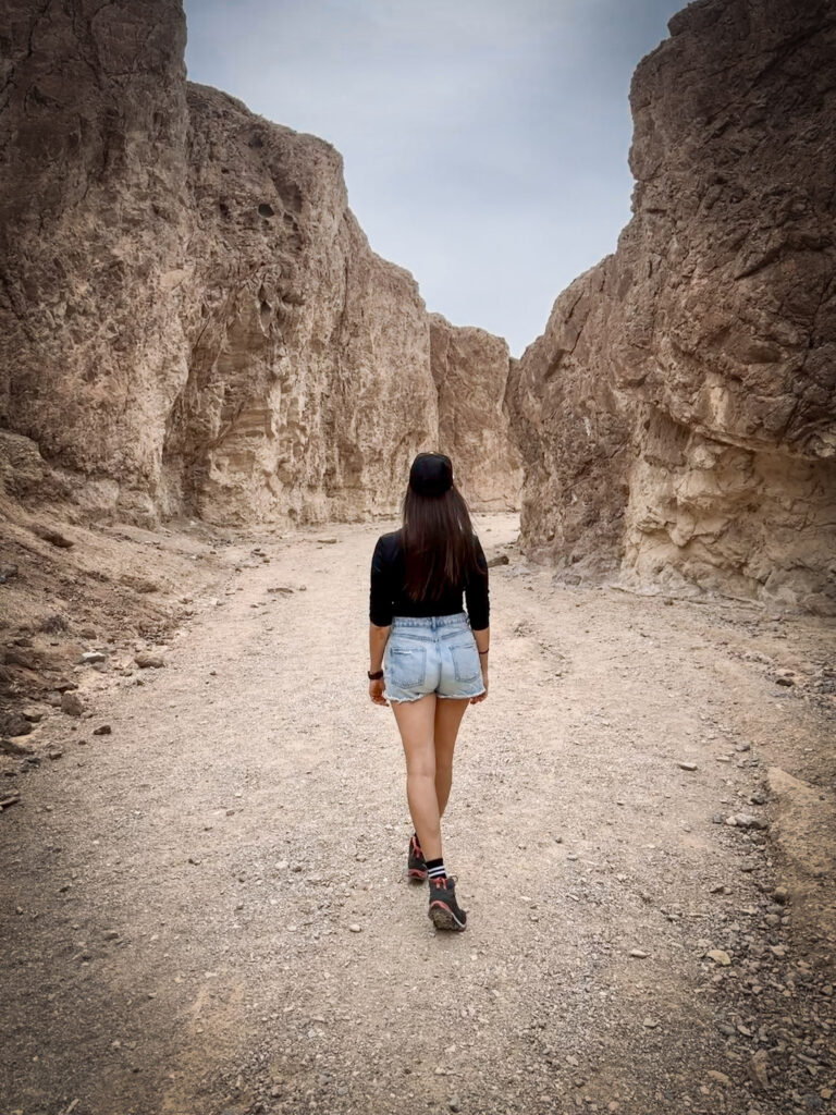
The first quarter mile into the canyon is immediately otherworldly — the walls closing in on both sides, the rock glowing gold in the morning light. Several side canyons branch off along the way, each offering their own short detours. At about 1 kilometre in, the trail forks: left toward Red Cathedral, right toward Zabriskie Point. Red Cathedral is the unmissable destination — the red rock is even more extraordinary up close, having eroded into dramatic pillars on the upper sections of the wall.
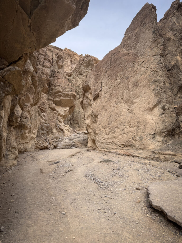
Fun Fact: Golden Canyon is actually where R2-D2 got captured by the Jawas in Star Wars Episode IV: A New Hope — which explains why it looks so much like another planet. You can still find chunks of old pavement from a road that once ran through the canyon before it was designated as a trail.

Useful Information: The trail is about 5 kilometres round trip to Red Cathedral and back, easy to moderate. The trailhead is on Badwater Road just south of Furnace Creek, with a small parking lot and vault toilets. Dogs are not permitted on this trail. For a longer adventure, the trail connects all the way to Zabriskie Point via the Badlands Loop — a 7.8 kilometre option if you have two cars to leave at each end.

Jet Lag Jelly Tip: Start as early as possible — the canyon walls provide welcome shade in the morning, but by late morning the sun hits directly and the heat builds fast. The parking lot was full by 10am on a weekday in February, which tells you everything you need to know about how popular this trail is.
Best Time to Visit
Death Valley is no joke in summer — temps regularly climb past 49°C (120°F), and it’s genuinely dangerous to hike or even walk far from your car. The best window is November to March, when daytime temps sit in a much more manageable 20-25°C (68-77°F) range. Spring (March-April) is a bonus if you catch a wildflower bloom year.
Jet Lag Jelly Tip: If you're visiting between May and September, stick to early morning or evening, and never leave pets or people in the car — even briefly. Death Valley's heat kills every year, and it doesn't discriminate.
Where to Stay
Death Valley is enormous, so where you stay depends on which part of the park you’re prioritizing.
Inside the park: The Oasis at Death Valley (Furnace Creek) is the main option — it’s actually two properties in one (the historic Inn and the more affordable Ranch), both right in the heart of the park near Badwater Basin and Zabriskie Point. Stovepipe Wells Village is a simpler, more budget-friendly alternative further north, closer to Mesquite Flat Sand Dunes.
Just outside the park: Beatty, Nevada (north entrance) and Pahrump, Nevada (closer to the Las Vegas side) both have cheaper motel options if you don’t need to be inside the park itself.
Given the size of the park and the driving distances between sights, staying inside at Furnace Creek or Stovepipe Wells saves you a lot of backtracking if you can swing it.
Browse places to stay near Death Valley to compare current options.
Budget
Backpacker: ~$30–50/day — camping, gas, park entrance fee, self-catered food
Mid-range: ~$90–150/day — rental car, budget motel or Airbnb in Furnace Creek/Pahrump, mix of dining
Luxury: $250+/day — The Inn at Death Valley, private guided tours, fine dining
Fun Fact: Death Valley's $30 vehicle entrance fee is valid for 7 days — worth it even for a single sunrise-to-sunset visit.
FAQ
How many days do you need in Death Valley? One full day is enough to see many of Death Valley’s major highlights, especially if you start early and plan your route carefully. Two days are better if you want to hike, spend more time at the viewpoints, or experience both sunrise and sunset without rushing.
Can you visit Death Valley without a 4WD? Yes. Most of the major attractions on this itinerary are accessible with a standard rental car, including Zabriskie Point, Badwater Basin, Artist’s Drive, Mesquite Flat Sand Dunes and Dante’s View. Some remote roads and areas of the park do require a more suitable vehicle, so always check current road conditions before heading out.
How far is Death Valley from Las Vegas? Death Valley is roughly a 2 to 2.5-hour drive from Las Vegas, depending on your destination inside the park. This makes it possible to visit as a long day trip, although staying overnight gives you more time to explore and experience the park without rushing.
Is Death Valley safe to visit? Yes, if you plan around the conditions. The biggest danger is extreme heat. Carry plenty of water, avoid strenuous hiking during the hottest part of the day, stay on established routes, and check weather and road conditions before setting out. In summer, even short walks away from your car can become dangerous.
Is there cell service in Death Valley? Cell service is very limited and can disappear completely in large parts of the park. Download offline maps before entering Death Valley, make sure your car has enough fuel, and don’t rely on your phone for navigation or emergency communication.
What should you not miss in Death Valley? If you only have one day, prioritize Zabriskie Point, Golden Canyon, Badwater Basin, Devil’s Golf Course, Artist’s Drive and Artist’s Palette, Mesquite Flat Sand Dunes, and Dante’s View. If you have extra time, add Ubehebe Crater for a completely different landscape.
Summary
Death Valley has a reputation that puts people off — the name alone sounds like a warning. But if you visit at the right time of year and come prepared, it’s one of the most extraordinary places you’ll ever set foot in. Not despite its extremes, but because of them.
In a single day you can stand at the lowest point in North America, walk through a golden canyon that looks like it belongs on another planet, watch the light turn volcanic hills every colour of the rainbow, hear salt crystals cracking in the heat, and end the day looking out over the whole impossible landscape from 1,600 metres above it all. Nowhere else does that.
Here’s the quick rundown of everything that is worth to cover in one day:
Zabriskie Point — Start here at sunrise. The golden badlands in early morning light are unforgettable.
Golden Canyon and Red Cathedral — The best hike in the park. Go early before the parking lot fills up.
Harmony Borax Works — A quick 15-minute stop that puts the whole landscape into human perspective.
Badwater Basin — Walk further out than everyone else. The silence and scale of the salt flats only hit you once the crowds are behind you.
Devil’s Golf Course — Strange, alien, and almost completely crowd-free. Don’t skip it.
Artist’s Drive and Artist’s Palette — The most unexpectedly colourful stop in a park full of surprises.
Mesquite Flat Sand Dunes — Walk barefoot, go early, and keep walking further than you planned.
Ubehebe Crater — A long drive north but a completely different kind of dramatic.
Dante’s View — Time it for sunset. Bring a warm layer. You’ll thank me later.
One day is enough to hit all of these if you start early and keep moving. Two days lets you breathe, linger, and maybe catch a sunrise at the dunes or a night sky that will genuinely make you stop talking mid-sentence.
Either way — just go.
Part of my Southwest national parks series — check out my Exploring Antelope Canyon, Horseshoe Bend Overlook Guide, Grand Canyon South Rim Guide, Valley of Fire Day Trip from Las Vegas, and Zion National Park: The Complete Guide posts too if you’re building out a bigger Arizona/Nevada itinerary — or start with my Best National Parks You Can Visit From Las Vegas roundup for the full picture.