
This post contains affiliate links. If you book through one, I may earn a small commission at no extra cost to you — it helps keep Jet Lag Jelly running. Read my full affiliate disclosure for more.
An hour northeast of Las Vegas, Valley of Fire State Park is one of those places that genuinely surprises you — not because you didn’t know it was beautiful, but because the scale and intensity of it is something no photo quite prepares you for. The Aztec sandstone formations are so deeply, brilliantly red they look like they’re actually on fire in the right light, and the variety of what’s here — arches, slot canyons, petroglyphs, dunes, wave rock — packs an astonishing amount into a relatively small area.
Valley of Fire State Park is Nevada’s oldest state park, featuring stunning red Aztec sandstone formations that are 150 million years old. Despite being so close to Las Vegas, it remains genuinely undervisited compared to the national parks on this road trip — which means you can have extraordinary landscapes almost entirely to yourself if you time your visit right.
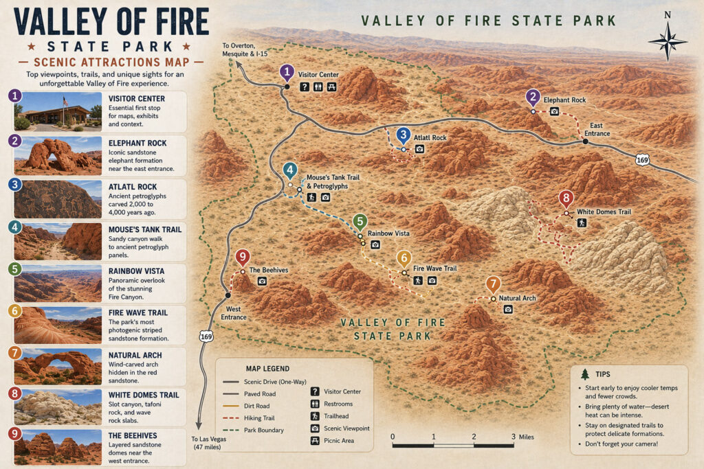
Valley of Fire Scenic Itinerary
1. Visitor Center — Essential first stop for maps, exhibits and context
2. Elephant Rock — Iconic sandstone elephant formation near the east entrance
3. Atlatl Rock — Ancient petroglyphs carved 2,000 to 4,000 years ago
4. Mouse’s Tank Trail — Sandy canyon walk to petroglyph panels
5. Rainbow Vista — Panoramic overlook of the Fire Canyon
6. Fire Wave Trail — The park’s most photogenic striped sandstone formation
7. Natural Arch — Wind-carved arch hidden in Fire Canyon
8. White Domes Trail — Slot canyon, tafoni rock, and wave rock slabs
9. The Beehives — Layered sandstone domes near the west entrance
Did You Know?
- Valley of Fire State Park is home to over 3,000 ancient petroglyphs created by Native Americans more than 2,000 years ago
- The red Aztec sandstone was formed from shifting sand dunes approximately 150 million years ago
- The park covers roughly 46,000 acres, making it much larger than most Utah state parks
- Located in the Mojave Desert, about 90 kilometres northeast of Las Vegas
- Nevada’s oldest state park, designated in 1935
- Best seasons: October through April — many trails close May through September due to extreme heat
Getting There: Valley of Fire lies 54 miles northeast of the Las Vegas Strip. Most visitors reach the park in 50 to 60 minutes by car. Take I-15 N and then NV-169 E — one of the most straightforward drives on the whole road trip. If you don't already have wheels, renting a car from Las Vegas is easy and gets you here in under an hour.

Entrance Fee: Nevada residents pay $10 per vehicle, while out-of-state visitors pay $20 per vehicle. No reservations needed — just drive up and pay at the entrance booth or self-pay station.

Park Hours: Open daily 6:00 AM – 9:00 PM. The visitor center is open from 9am to 4pm. Note that many of the park's trails are closed annually May 15 through September 30 due to extreme heat — these trails have a history of frequent medical calls, search and rescue missions, and fatalities during this time of year. The best time to visit is October through April.

Getting Around: The scenic drive takes about 2 to 3 hours to complete if you make stops at key viewpoints. The roads are well-maintained and suitable for all vehicle types. The park has three main roads — the Valley of Fire Highway running east to west, Mouse's Tank Road branching north, and the Loop Road at the west entrance.

How Long to Spend: A half day covers the highlights comfortably. A full day lets you do all the main trails without rushing — and the more time you give it, the more it rewards you.
1. Visitor Center
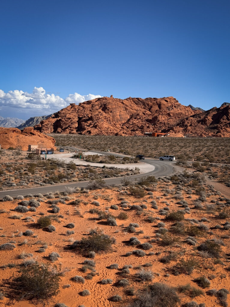
The Visitor Center provides exhibits on the geology, ecology, prehistory and history of the park and the nearby region. It is strongly recommended that each visitor make this an early stop after entering the park. A brand new visitor center opened in spring 2026, so the facilities are now excellent — pick up a trail map, fill your water bottles, and use the restrooms before heading out into the park.
Fun Fact: Valley of Fire was established in 1935 as Nevada's first state park, created to protect its striking red Aztec sandstone formations and ancient cultural sites. The park now attracts nearly one million visitors a year.

Useful Information: The visitor center is open daily from 9am to 4pm. Free with park entry. Restrooms, water filling station, maps, books and souvenirs available. Pets not allowed inside.

Jet Lag Jelly Tip: Take a photo of the park map at the visitor center — printed maps can be scarce, and the trails in the park aren't always well marked once you're out in the desert.
2. Elephant Rock
One of the first and most immediately recognisable formations in the park — a massive sandstone rock that has been eroded into the unmistakable silhouette of an elephant, trunk and all, standing against the blue Nevada sky. It’s right near the east entrance, making it a natural first stop after driving in from Las Vegas.
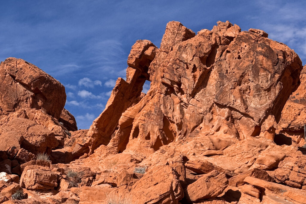
Once you see the elephant shape, you absolutely cannot unsee it. The horizontal layering in the rock adds to the effect, almost making it look like a carved sculpture rather than a natural formation.
Fun Fact: Elephant Rock is one of the most photographed formations in Valley of Fire and sits right near the east entrance, making it one of the first dramatic sights you encounter driving in. The elephant silhouette is most obvious from slightly to the left of the formation.

Useful Information: Elephant Rock trail is short and accessible, just 0.3 miles. There's a small parking area right off the main road and it's a very short walk to the formation — no hiking boots required.

Jet Lag Jelly Tip: Walk around to different angles — the elephant silhouette changes dramatically depending on where you're standing. The shape is most convincing from slightly to the left, with the trunk clearly visible against the sky.
3. Atlatl Rock
One of the most accessible and rewarding petroglyph sites in the American Southwest — a large red sandstone rock face with an extraordinary panel of carvings that you reach via a metal staircase bolted directly into the rock. The carvings are extraordinary in their detail: human figures, animals, spirals, handprints, and most notably the atlatl itself — an ancient spear-throwing device that gives the rock its name.
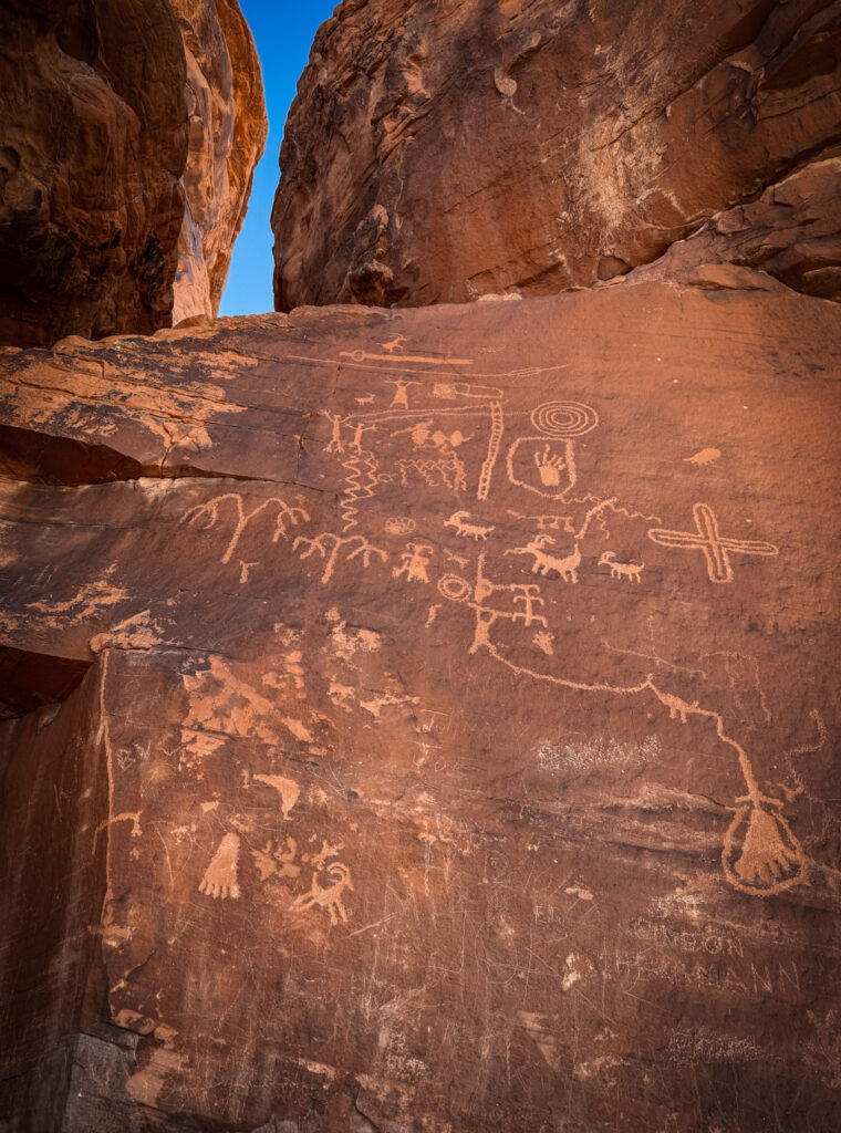
The carvings are estimated to be between 2,000 and 4,000 years old. One thing most people miss: there are additional petroglyphs at the base of the rock, just a short flat walk from the parking area, that are equally detailed and far less crowded since most visitors head straight for the staircase. Take the extra couple of minutes to walk the base panels before or after going up.
Fun Fact: An atlatl is a spear-throwing tool used by ancient hunters — essentially a lever that extended the thrower's arm and allowed them to launch a spear with far greater force and distance than throwing by hand alone. The carved depictions here are some of the best preserved examples of atlatl imagery in the Southwest.

Useful Information: The staircase with a metal railing takes you right up to the main petroglyph panel — no serious hiking required, accessible for most people. There's a small parking area and picnic tables at this stop. Please do not touch the petroglyphs — the oils from human skin cause permanent damage to the carvings.

Jet Lag Jelly Tip: Early morning light hits the Atlatl Rock petroglyphs directly and makes the carvings far more visible and photogenic than midday light — if you can, make this your first stop of the day.
4. Mouse’s Tank Trail
A short canyon walk through a wide, sandy wash between tall red sandstone walls, leading to one of the best concentrations of petroglyph panels in the park. The trail itself is as much of the experience as the destination — walking through the sandy canyon with the walls rising on both sides and just the blue sky above, completely silent except for the wind, feels like a place that hasn’t changed in centuries.
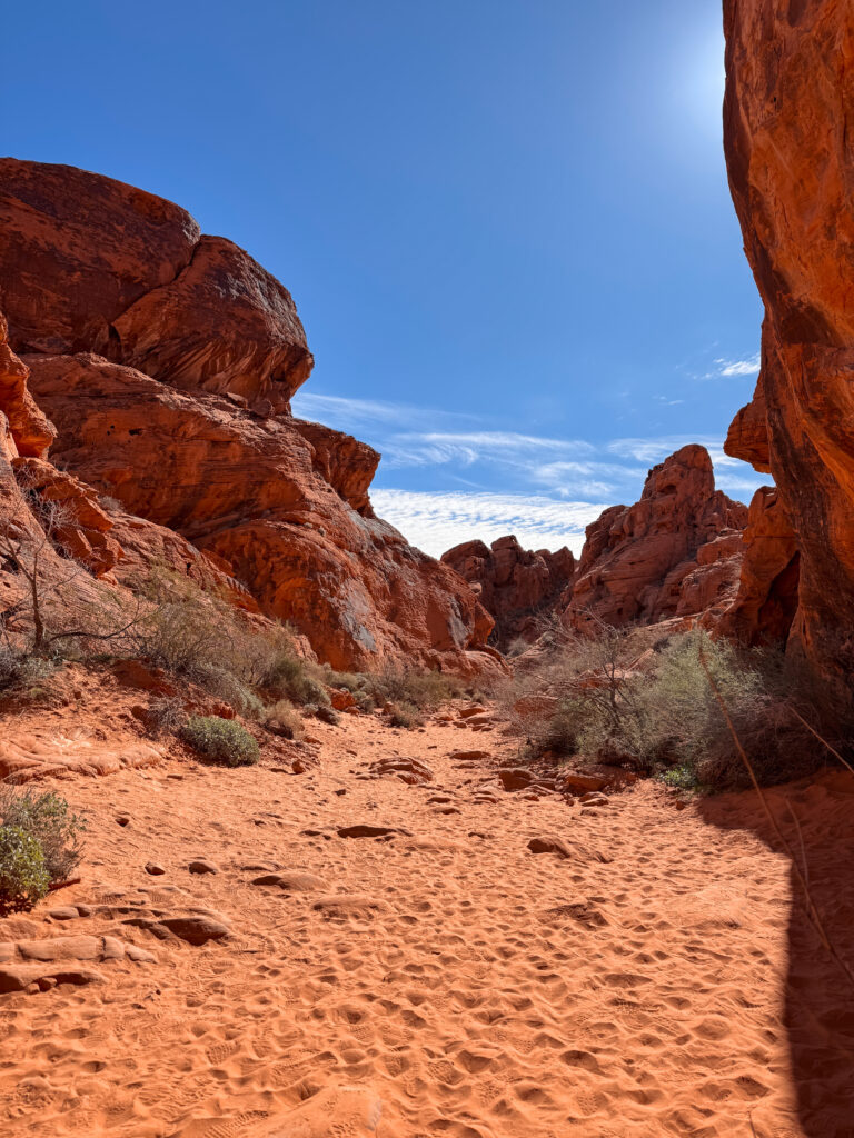
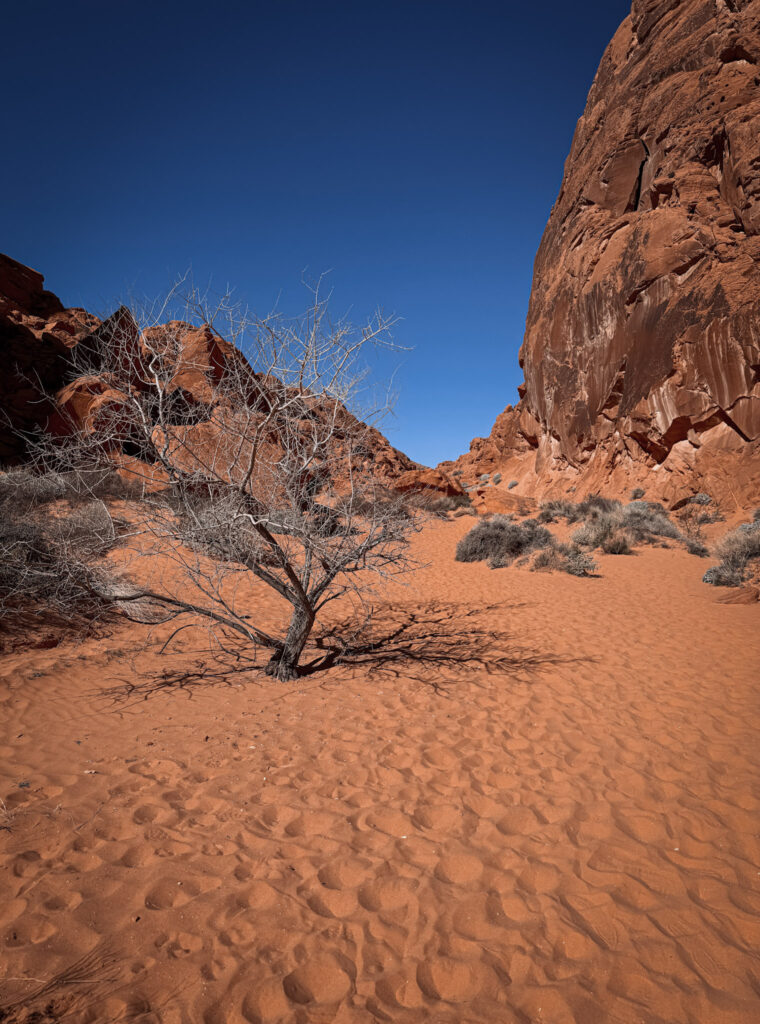
Which is exactly the right mood to be in when you come face to face with carvings that are thousands of years old.
Fun Fact: "Mouse's Tank" refers to a natural basin in the rock that collects rainwater — named after a Southern Paiute outlaw named Mouse who reportedly hid in the canyon in the late 1800s, surviving on the water collected in the rock basin.

Useful Information: The trail is about 1.2 kilometres return, flat and easy. Multiple petroglyph panels appear along the canyon walls throughout the walk — keep your eyes on the rock faces on both sides rather than just the path ahead. No permit required.

Jet Lag Jelly Tip: Go slowly and look carefully — the petroglyphs are easy to miss if you're scanning the rock face from a distance. Let your eyes adjust to the texture of the stone and the individual carvings reveal themselves.
5.Rainbow Vista
A short trail to a panoramic overlook of Fire Canyon — an extraordinary view over multi-coloured sandstone hills and sweeping desert vistas that gives you a sense of the full scale of the park from above. The name is no exaggeration — the rock here transitions through shades of red, orange, pink, cream, and purple depending on the angle of the light.
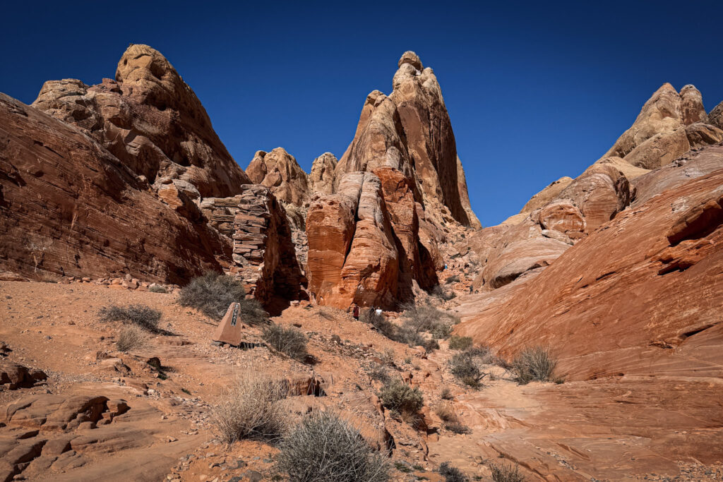
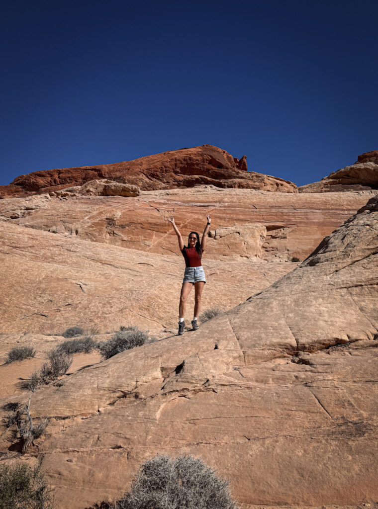
Fun Fact: Rainbow Vista is also the starting point for the Fire Wave Trail — most hikers combine both in a single visit, starting with Rainbow Vista for the overview before descending to the Fire Wave formations below.

Useful Information: The Rainbow Vista Trail is about 1.6 kilometres return, easy and relatively flat. The trailhead is on Mouse's Tank Road with a dedicated parking area. Best visited in the morning when the light comes in at an angle and brings out the colour range in the rock.

Jet Lag Jelly Tip: The Mouse Tank Viewpoint just a short climb near the Rainbow Vista trailhead rewards you with a wide overlook of the road snaking through the red rock landscape — a classic Valley of Fire perspective that makes a great photo without needing a full hike.
6. Fire Wave Trail
Fire Wave is probably one of the most gorgeous spots in Valley of Fire and features white and red zebra stripes that create incredible photo opportunities. The formations here look almost painted — smooth, undulating layers of white and deep red sandstone flowing together like waves frozen in rock, created by different mineral content in alternating layers of ancient dunes.
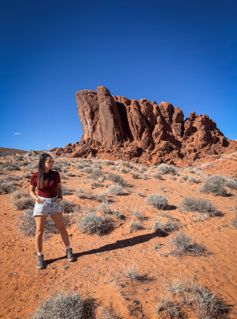
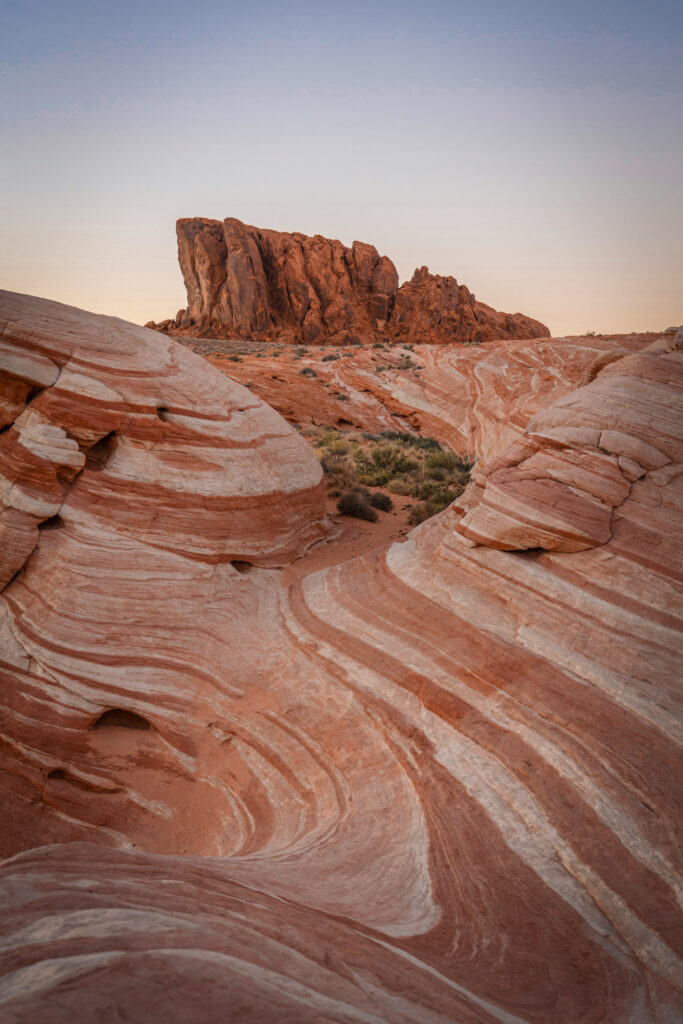
It’s one of those places where every angle looks like a postcard and you end up taking far more photos than you planned.
Fun Fact: The Fire Wave's distinctive striped pattern comes from alternating layers of iron-rich red sandstone and silica-rich white sandstone, deposited by shifting wind patterns over millions of years and then sculpted by erosion into these smooth, flowing forms.

Useful Information: The Fire Wave/Seven Wonders Loop trail is one of the trails closed annually from May 15 through September 30 due to extreme heat. The trail is approximately 3 kilometres return, easy to moderate. Download the trail on AllTrails before you go — it's easy to lose the path on the open rock slabs.

Jet Lag Jelly Tip: Morning light is best here — the low sun angle catches the stripes dramatically and the colours are at their most vivid before midday flattens everything out. Get here early and you may have the formations completely to yourself.
7. Natural Arch
Tucked away near the east entrance on a trail that doesn’t appear on the standard park handout map, the Natural Arch area runs through Fire Canyon — a broad, sandy wash with sweeping canyon walls and several natural arches and windows carved by wind and water erosion over millions of years. Standing underneath one of the arches and looking up through the frame of deep red rock to the blue sky above is one of those views that genuinely doesn’t need a filter.
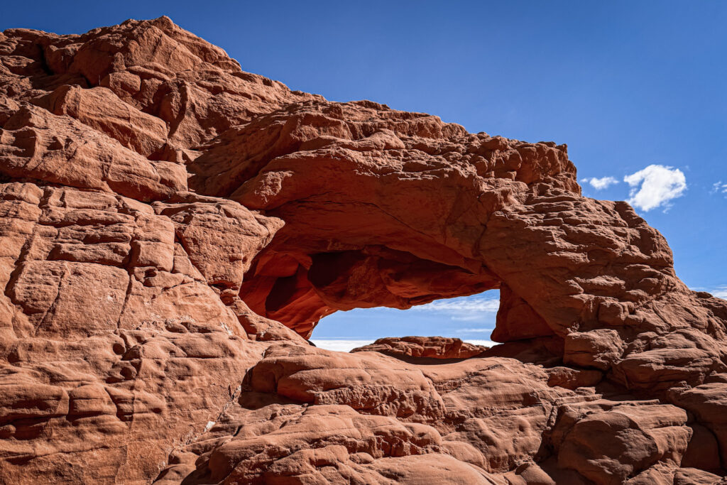
Fun Fact: Fire Canyon, which the Natural Arch trail runs through, contains numerous natural arches and balancing rocks all the way to the Silica Dome area — making the whole canyon worth exploring beyond just the arch itself.

Useful Information: The Natural Arch Trail (excluding Arch Rock) is one of the trails closed annually from May 15 through September 30. The full trail is about 4.2 miles out and back, moderately challenging with soft, energy-draining sand throughout. Even a short walk into the canyon wash gives a taste of the formations. Download the trail on AllTrails before you go — there are no markers along the route once you're in the wash.

Jet Lag Jelly Tip: The light coming through the arch in late afternoon turns the rock almost glowing orange — if you can time your visit for late afternoon, it's worth it.
8. White Domes Trail
The best trail in Valley of Fire — a short loop that takes you through a narrow slot canyon with smooth, striated walls, past tafoni rock faces covered in mysterious round holes, and out onto broad sweeping slabs of smooth pink and white rock that you can scramble up freely, with the whole valley spread out below you.
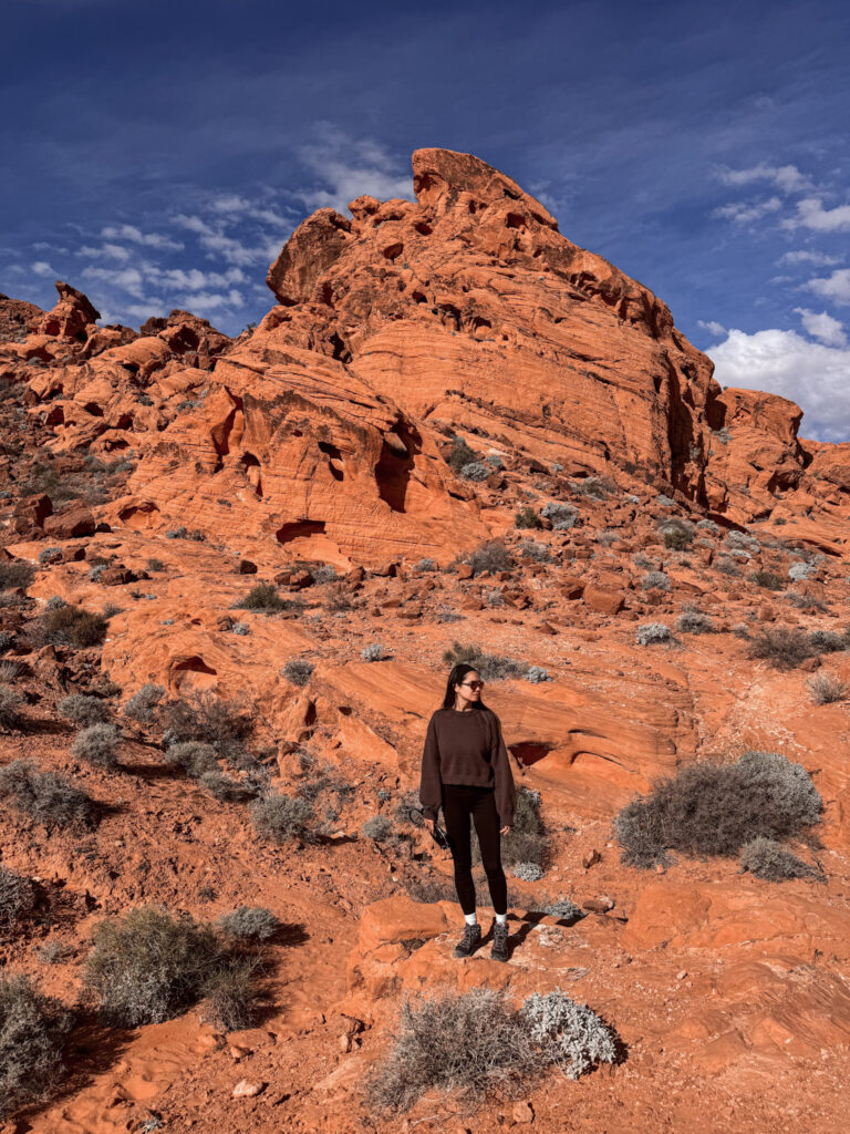
Before you even reach the slot canyon, the trail opens up into a dramatic natural amphitheatre of towering rock spires — red, orange and cream-white formations rising up on all sides, with tiny figures of other hikers at their base reminding you just how massive these things actually are.
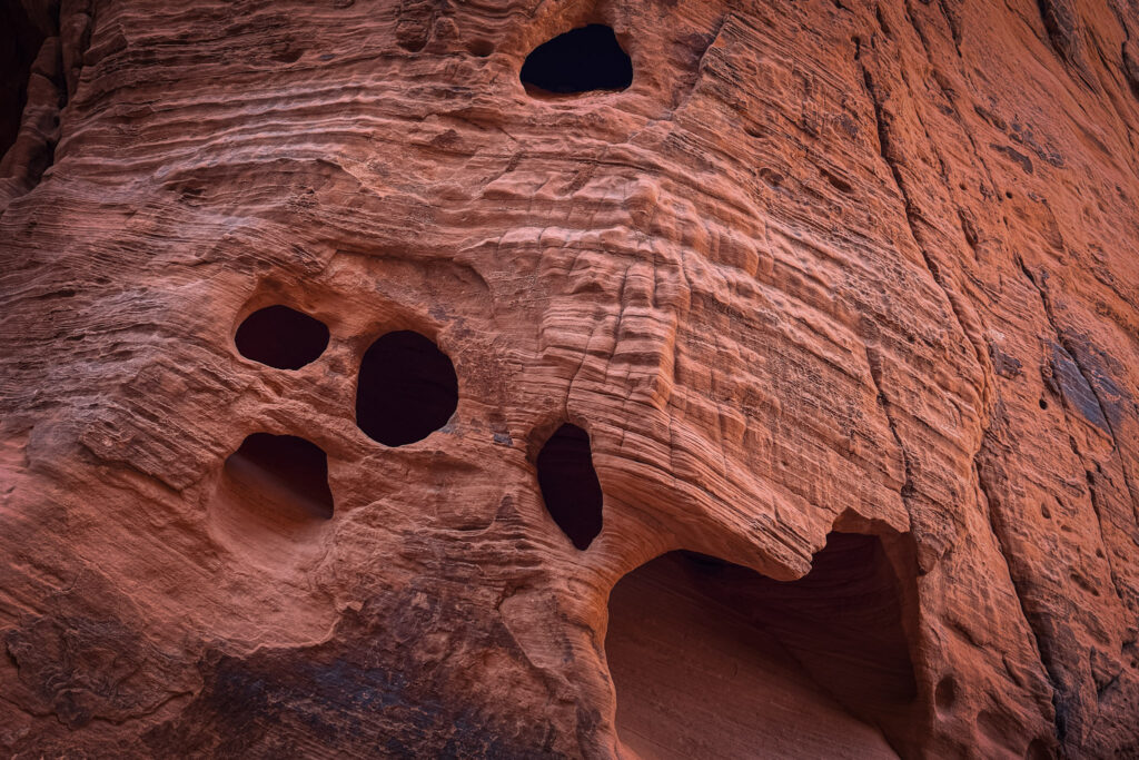
Along the trail you’ll also come across rock faces covered in what looks like the stone has been slowly eaten from the inside — round, dark holes of all sizes pockmarking the smooth layered sandstone in clusters. These are called tafoni, a type of cavernous weathering where wind, moisture, and salt slowly hollow out softer pockets in the rock over thousands of years, leaving behind these cave-like openings. It looks almost like the rock is staring back at you — and if you look closely at the slot canyon walls themselves, you’ll spot them there too, tucked into the smooth striated rock right next to you as you walk through.
Then the walls close in. The slot canyon section of White Domes is short but genuinely beautiful — pale, smooth sandstone rising up on both sides, the walls almost close enough to touch with both hands, just a thin strip of blue sky far above. And unlike Antelope Canyon, completely free and unticketed. The smooth rock slabs afterwards are the kind of place you could sit for an hour and just look out at the desert.
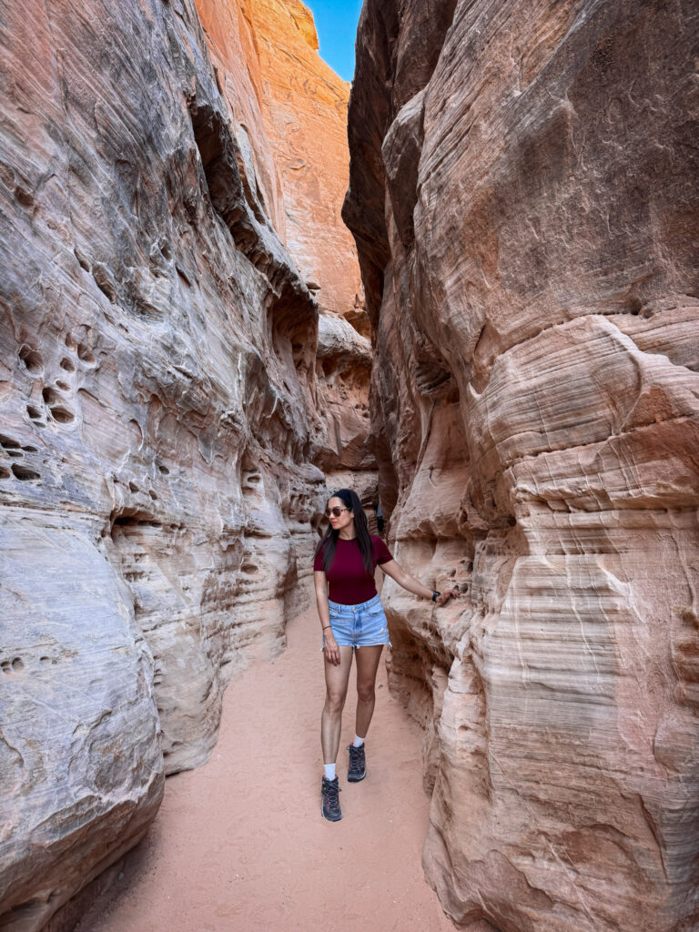
Fun Fact: The White Domes Trail shows off the park's stunning scenery including desert vistas and reveals the namesake colors of the rock, a slot canyon, caves, and even a historic movie site where the 1966 film "The Professionals" was shot.

Useful Information: The White Domes Loop is one of the trails closed annually from May 15 through September 30. The loop is about 2 kilometres, easy to moderate, and one of the most varied short trails in the park. Download the trail on AllTrails — it's easy to veer off course on the open rock sections.

Jet Lag Jelly Tip: Wear shoes with grip for the smooth rock sections — the slabs look flat but have enough pitch to be slippery in spots. And keep walking all the way to the end of the loop rather than turning back at the slot canyon — the wave rock slabs at the far end are worth every extra step.
9. The Beehives
One of the first things you see driving into Valley of Fire from the west entrance — a cluster of rounded, conical sandstone domes that genuinely, unmistakably look like giant beehives. The horizontal banding and grooved lines running across their surfaces make them look almost hand-stacked rather than naturally formed.
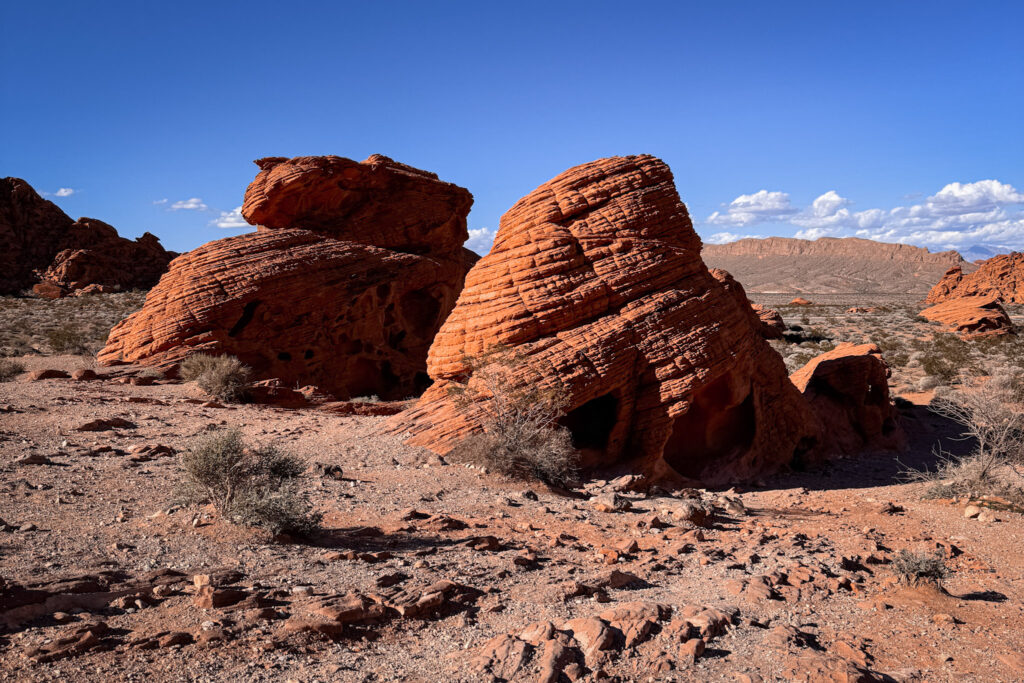
The colours range from deep red and orange to softer pinks and yellows depending on the light, and the texture of the layering is much more impressive up close than from the road.
Fun Fact: The distinctive grooved lines on the Beehives aren't just decorative — they're a textbook example of cross-bedding, where different layers of ancient sand were deposited at different angles by shifting winds over millions of years. The rounded, smooth shape is the result of millions of years of wind and water erosion sculpting the Navajo Sandstone.

Useful Information: There's a small parking area right off the main road near the west entrance with an information kiosk explaining the geology. No hiking required — you can see them clearly from the car park, though getting closer is well worth the extra few minutes.

Jet Lag Jelly Tip: Morning light hits the Beehives from the east and makes the layered banding really pop — if you're entering from the west entrance, loop back here on your way out when the light is at its best.
Best Time to Visit
Valley of Fire sits at lower elevation than Zion or the Grand Canyon, so it heats up fast — summer temps regularly hit 40°C+ (104°F+), making midday hikes brutal. October to April is the sweet spot, with mild, comfortable temps and good light for photos (that red rock glows even more at sunrise/sunset). I visited in February and it was perfect — clear skies, cool mornings, and warm enough by midday to hike comfortably without overheating.
Jet Lag Jelly Tip: This park is small enough to do as a half-day or full-day trip from Vegas — no need to overnight unless you want sunrise/sunset shots without the drive.
Where to Stay
Valley of Fire doesn’t have hotels within the park itself — most visitors base themselves in Las Vegas and do this as a half-day or full-day trip. Staying anywhere near the Strip or Downtown works fine, since it’s under an hour’s drive either way. If you want to camp closer to the park itself, Valley of Fire State Park has a small campground with basic sites (no hookups), which is worth considering if you’re chasing sunrise or sunset light without the drive back. Browse hotels in Las Vegas to find something close to the Strip or Downtown depending on your plans.
Budget
Backpacker: ~$20–35/day — self-drive, park entrance fee, packed lunch, no lodging needed if day-tripping from Vegas
Mid-range: ~$70–120/day — rental car, casual dining, maybe a guided tour add-on
Luxury: $200+/day — private guided tour, upscale dining back in Vegas, professional photography add-ons
Fun Fact: Valley of Fire is Nevada's oldest and largest state park, and the entrance fee is just $15 per vehicle — one of the cheapest stops on this whole road trip.
FAQ
How far is Valley of Fire from Las Vegas? About 54 miles (roughly 90 km) northeast, a 50–60 minute drive via I-15 N and NV-169 E — one of the most straightforward drives in the area.
Is one day enough for Valley of Fire? Yes — a half day covers the highlights, and a full day lets you do all the main trails without rushing. It’s a comfortable day trip from Vegas with no need to overnight.
What’s the best time of year to visit Valley of Fire? October through April. Summer temperatures regularly hit 40°C+ (104°F+), and several trails actually close from May 15 through September 30 due to extreme heat.
How much does it cost to visit Valley of Fire? $10 per vehicle for Nevada residents, $20 for out-of-state visitors — no reservations needed, just pay at the entrance booth.
What’s the best trail in Valley of Fire? White Domes Trail — a short loop combining a slot canyon, tafoni rock formations, and sweeping pink-and-white rock slabs, all in about 2 km.
Summary
Valley of Fire is what happens when you give an incredible landscape a fraction of the attention it deserves. One hour from the Las Vegas Strip, completely free of the crowds that pack the national parks further north, and with enough variety — arches, slot canyons, petroglyphs, wave rock, dunes, beehives — to keep you exploring all day.
Here’s the quick rundown of everything covered:
Visitor Center — Start here. Pick up a map, fill your water, check trail conditions.
Elephant Rock — Two minutes from the car park. Cannot be unseen.
Atlatl Rock — Don’t skip the base panels. Just as good as the staircase ones.
Mouse’s Tank Trail — Go slowly. The petroglyphs reveal themselves gradually.
Rainbow Vista — The view that puts the whole park in context.
Fire Wave Trail — Go early. Take more photos than you think you need.
Natural Arch — Download AllTrails first. Worth every step of the sandy canyon.
White Domes Trail — The best trail in the park. Do the full loop.
The Beehives — A perfect last stop before heading back to Vegas.
One day is enough for all of this. But Valley of Fire is the kind of place where you’ll find yourself looking at the photos afterwards and immediately thinking about going back.
Part of my Southwest national parks series — check out my Exploring Antelope Canyon, Horseshoe Bend Overlook Guide, Grand Canyon South Rim Guide, Zion National Park: The Complete Guide, and Death Valley Must-See Stops posts too if you’re building out a bigger Arizona/Nevada itinerary — or start with my Best National Parks You Can Visit From Las Vegas roundup for the full picture.